Archive for January, 2015

Birding At White Water Draw

January 28th, 2015 by Mike Hug

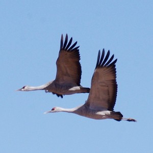
Birding at White Water Draw more than just Sandhill Cranes

Sign Picture

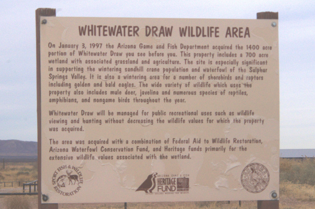
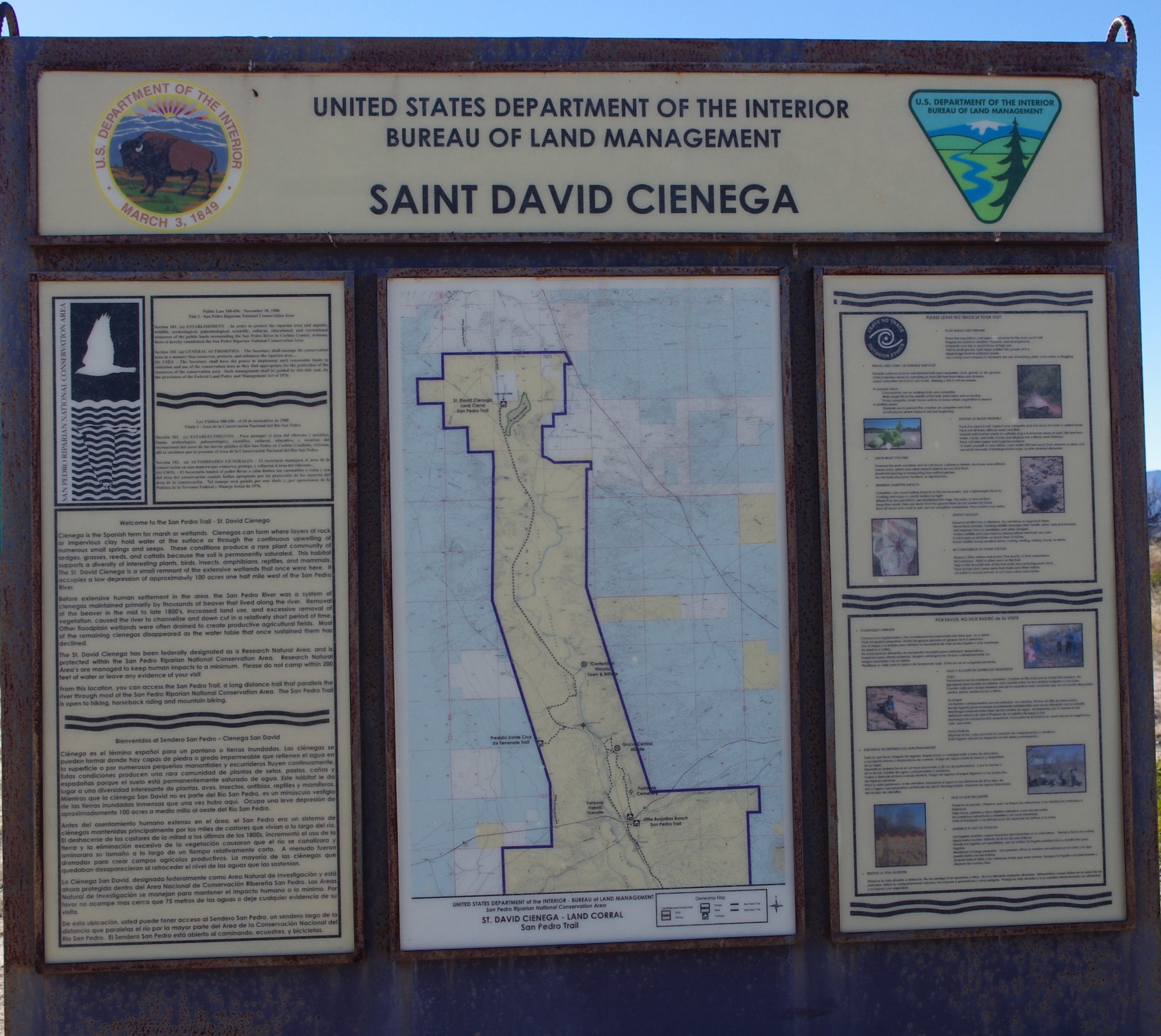
The sign at the entry to White Water Draw tells you about the property

Birding at White Water Draw is best done during the winter and early spring months. That is when the lake is full and the birds that winter in Southeast Arizona are in residence. The birding at White Water Draw isn’t as well known as the Willcox Playa where “Wings Over Willcox” is highlighted. In my opinion, the birding at White Water Draw, near McNeal, is better for close up photography of the cranes. Down By The River B and B is north west of White Water Draw and easily accessible by good roads. After you have a scrumptious breakfast at the b and b, you can be in White Water Draw to view the birds to your heart’s content for the rest of the day.

Birding white water draw picture

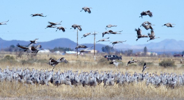
The Sandhill Cranes come in to White Water Draw after feeding in the morning. Large numbers winter here in Cochise County.

birding at White Water Draw picture

Sandhill Cranes flying in from feeding north of White Water Draw.

Angie and I took a day trip to White Water Draw, about an hour’s travel time.

Read the rest of this page »

Restaurants in Cochise County

January 22nd, 2015 by Mike Hug

Restaurants in Cochise County – Bisbee Has Great Dining

Bisbee Overlook Picture

Bisbee is nestled in a canyon and is a wonderful place to spend the day and has some of the finest restaurants in Cochise County.

A common question our guests ask about is “Are there good restaurants in Cochise County?” Down By The River B and B is centrally located in Cochise County and when our guests go out they would like to find a restaurant that is close to where they are spending the day. To that end we have made a list of restaurants from various parts of Cochise County and have that posted on our website. We only recommend restaurants to our guests where we have dined and enjoyed the experience. It doesn’t include every restaurant is open but it has to meet our standards.

Read the rest of this page »

Cochise County Shrine After The Fire

January 16th, 2015 by Mike Hug

Cochise County Shrine Risen From The Ashes After The Fire

Cochise County Shrine Picture

The road to the shrine leads toward Ash Canyon and had a nice view of the Huachucas.

As I described the history of the Cochise County Shrine named Our Lady of the Sierras in my last blog,  I want to tell you about what it is like now after the fire. At the bottom of the complex is Mary’s Knoll which includes the visitor center, prayer center and business offices. This building was also totally destroyed by the fire. It has been rebuilt and was reopened in 2014. Parking for large vehicles is at this location. The steep drive up the hill is meant to be used only by cars.

Cochise County Shrine Picture

The path of the Stations of the Cross is an uphill climb but has rest areas at the stations.

Angie and I took some time to go to the Cochise County shrine just after New Year’s Day. It seemed appropriate to start the year off by visiting the shrine with our friend Karl. He didn’t know he would be on a trail with a slope that reminded him of the Grand Canyon hike we had taken together back in the mid 90s. But at least it wasn’t as long as that trail and there were many benches to stop and rest on along the way. The areas where we could stop were locations of each Station of the Cross. Most spots had a metal plaque that showed the station. There are still some stations that have not been repaired yet. The trail leads up the mountainside and past the Chapel and statues to a point that ends at the burial chamber grotto and the last station. Along the way was a Nativity Scene although that is installed during Christmas time.

Read the rest of this page »

Our Lady Of The Sierras Shrine

January 10th, 2015 by Mike Hug

Our Lady Of The Sierras Shrine A Short History

Our Lady of the Sierras Shrine picture

Our Lady of the Sierras Shrine is located at the southern end of the Huachuca Mountains.

Our Lady of the Sierras Shrine is located in Cochise County almost to the Mexican border on the side of the picturesque Huachuca Mountains. It is located near the Coronado National Memorial which I wrote about in a blog on September of 2013. This part of Cochise County is known for its beauty with the canyons and great vistas.

Our Lady of the Sierras Shrine picture

The driveway to the shrine has this rock with the name at the entrance.

The history of the Our Lady of the Sierras Shrine started in 1987 when the Chouinards visited family members and decided to hike into Ash Canyon. There they found a for sale sign and later bought the 8 acre property in 1988. This was to be the site for their retirement home which they built in 1991 then retiring to the area. Prior to building the home they had taken a pilgrimage to a church in Medjugorje, Yugoslavia where spiritual events had been occurring. After they had finished their home they decided to erect a cross and Patricia stated that she would like a statue of Mary next to it. This appeared to be a relatively simple task that should be easy to accomplish.

Read the rest of this page »

St. David Cienega

January 5th, 2015 by Mike Hug

St. David Cienega

St. David cienega picture

The map of the St. David Cienega is shown on the large map of the San Pedro Riparian NCA.

St. David Cienega picture

The road and the old railroad bed both lead to the St. David Cienega.

I talked about the history of the St. David Cienega, a remnant of the massive marsh system that was around the San Pedro River in my last blog. To reach St. David Cienega you must make a right turn onto Cary road from Escalante Rd. You can drive in all the way to the parking lot or park at this intersection and walk in about a mile. Cary Road ends at the old corrals. Alongside Cary road is the old rail bed of the Southern Pacific line that ran down to Douglas. The tracks have been pulled up in the last 4 years. You can walk on the rail bed and look for spikes that were left behind when the crews pulled up the rails and ties. You are elevated above the road using this route so it allows for a view that is not as obstructed as the one on the road. There are also some photo opportunities of old abandoned houses and ruins that can be seen along the way.

Read the rest of this page »

  • Archives

  • Categories

»