Coronado National Memorial – a short day trip visit.

The map is courtesy of the National Parks Brochure for Coronado National Memorial.
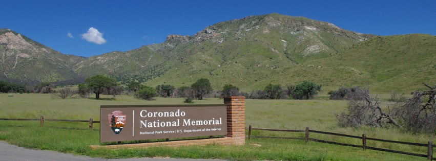
The entrance to the Coronado National Memorial is a photogenic setting.
Coronado National Memorial is located on the Mexican Border. It is south of Sierra Vista where Arizona Route 92 veers away from the Huachuca Mountains and heads east to Bisbee. Close to the Coronado National Memorial’s location is the route traversed by Francisco Coronado when he was sent to find the fabled cities of Cibola or the Lost Cities of Gold. He was following the orders of The Viceroy of New Spain (Mexico) Antonio Mendoza to mount an expedition to find these cities. A Fray, Marco De Niza was sent along because he had reported seeing these cities. The expedition failed in finding the cities but the members of the expedition did record what the land and the inhabitants were like from Northern Mexico, Arizona, New Mexico, Texas and on to present day Kansas. The Grand Canyon was first seen by Europeans on this expedition when part of the group ventured to the Northwest. If you want to read an interesting book, find the one Douglas Preston wrote titled “The Lost Cities of Gold”.
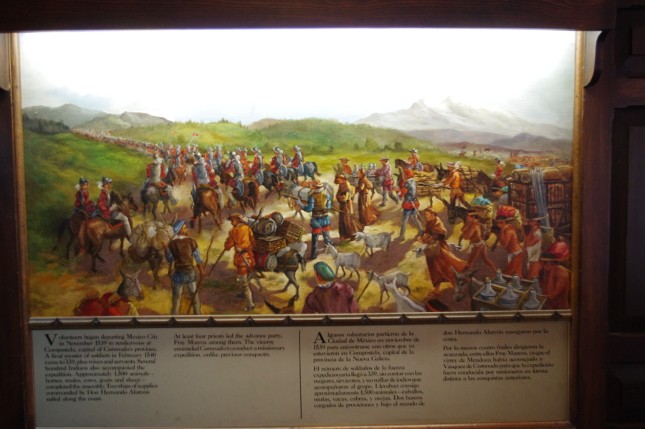
Paintings that document The Coronado Expedition are placed in the Coronado National Memorial Visitor Center and give a description of the event.
The Coronado National Memorial sits at the southern end of the Huachuca Mountains and it is one of the unique locations in the United State. It is a crossroad of diversity with the Rocky Mountains ending, the Sierra Madre Mountains beginning, and where the Chihuahuan and the Sonoran Deserts meet. There are many plants and animals that can be found in the park. This is one of the few areas in the US where you can find the Lucifer Hummingbird. Coatimundi can be seen in the park along with Javelina. Bird watchers enjoy the Huachuca Mountains and these sky islands are home to many birds that are seen nowhere else in the US. The visitor center is about half way into the park on East Montezuma Canyon Road. It has items for purchase and has good information on the Memorial and surrounding area. There are paintings on display depicting Coronado and the expedition. It is well worth the stop.
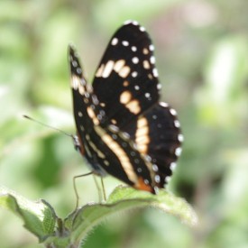
The Border Patch Butterfly is one of many species found in Coronado National Memorial.
Hiking along with nature watching are the main things to do in the park. There are trails in the park with two starting at the Visitor Center. One hike heads north to Coronado Cave from the Visitor Center on a trail that is ¾ of a mile in length and gains about 500 feet in elevation. This is a limestone cave with some formations. You will need flashlights and it requires a permit to enter. The second trail is Joe’s Canyon Trail and it is about 3 miles long and rises 1600 feet in elevation. This trail ends on the Coronado Peak trail. Near the 2 mile point on the Joe’s Canyon Trail is the junction of the Yaqui Trail. This trail goes south to the border and marker pole 102. These poles weigh about 700 pounds and they were placed by the government in the 1890s to designate the border. The poles start near El Paso and head west. Poles 100, 101 and 102 are located inside the Coronado National Memorial. From Montezuma Pass Overlook there is The Coronado Peak Trail of almost a half a mile in length. The peak is 6864 feet in elevation and gives you a great panoramic view of the San Pedro and San Raphael Valleys. The Arizona Trail starts in the Coronado National Memorial at border Pole 102. It heads north out of the Memorial over the Huachuca Mountains for 800 miles until it stops at the Utah border north of the Grand Canyon.
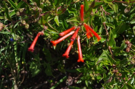
Many different flower varieties can be found throughout the Coronado National Memorial grounds. These flowers are from the Firecracker bush.
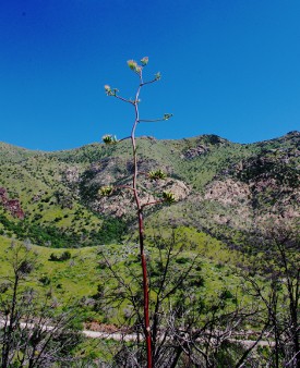
For this trip, Angie and I decided that we would hike the Coronado Peak trail. The road to Montezuma Pass turns to dirt about 1 mile after leaving the visitor center. It is narrow but in good repair and a normal automobile will not have a problem navigating the road. There are places to pull off to see items of interest. With all the rains this monsoon season, there were a lot of flowers blooming on both sides of the road. The Century plants were in the process of blooming and some of the stocks were 15 feet tall. With all the rains we have had in the mountains, the vegetation was very lush. When you reach the top of the pass, you can park and there are tables if you want picnic. We started the hike to the top and it was a pretty steady climb with a 300 foot rise in elevation from the parking lot. We had lots of opportunities to take pictures and we made the best of it. Coronado Peak is less than a mile from the border. At the top of the mountain, you can see into Mexico at least 70 miles and to the foothills of the Sierra Madres and the copper mine at Cananea 30 miles away. To the west we could see Baboquivari Peak over 80 miles away. The peak is sacred to the O’odham Native Americans. The views were wonderful with deep blue sky.
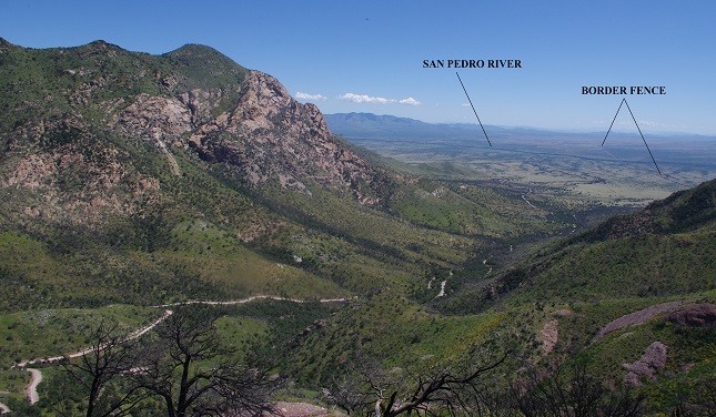
The view from Montezuma Pass overlook is toward the San Pedro River Valley. The River is defined with the tree line. The border fence is the dark straight line that runs east and west.
As we got back to the car we found that we had only traveled 59 miles from Down By The River B and B. Our b and b is perfect hub location for the guest that wants to take short day trips to many sites throughout Cochise County. After the hike, we discussed our options. It was starting to get a little too warm to start another hike. The Yaqui trail was a 2 mile hike one way down to the border and we didn’t feel we had enough water for that. We decided that we would drive a loop trip back to the b and b instead of returning straight
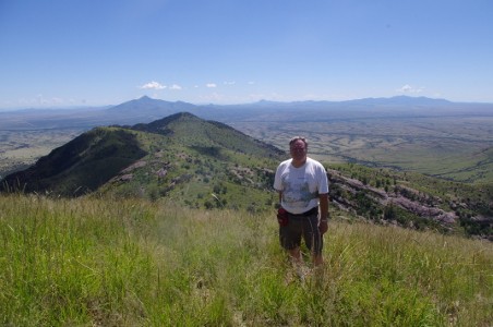
Mike on Coronado Peak with the backdrop of Mexico behind him to the southeast.. Some of he peaks are over 70 miles away.
home. There are 2 choices we considered. One is to go to Bisbee, prowl the shops and get something to eat later. The second option was to continue west on the Montezuma Canyon Road, stopping at Parker Canyon Lake. From there we would travel on to Sonoita. Since neither of us had been to Parker Canyon Lake, we decided to take the dirt road and see what it was like. When we were young my dad took us out on back roads, he would tell us that we were going “Boondocking”. We knew it would be an adventure since you never knew what you would find or where we were going. We will tell you about our “Boondocking” adventure to Parker Canyon Lake in our next blog.
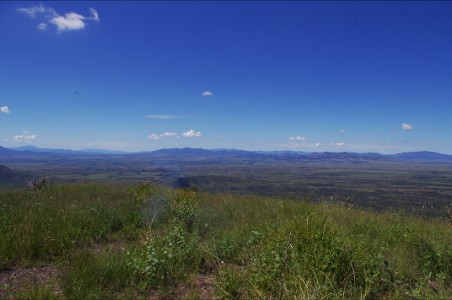
From the top of Coronado National Memorial looking to the Southwest into Mexico.