Archive for the ‘Outdoor Recreation’ Category

Southeast Arizona Parks

May 27th, 2015 by Mike Hug

Southeast Arizona Parks – The Unknown Jewels

Cochise County Map of Attractions

Down By The River B and B is “The Lodging Hub of Cochise County” and you can see all the things to do in the area from this map

Southeast Arizona parks and historic sites are not as well known or frequented like the Grand Canyon but have their own charm that will delight you when you visit this part of Arizona. The better known park in this part of Southeast Arizona is Kartchner Caverns State Park. But we have many guests from Arizona that have never heard of it. Tombstone is a National Historic Site best known as the site of the Gunfight at the OK Corral. For some reason, the majority of parks in Southeastern Arizona are one of the best kept secrets around. So let me give you a quick review of places that you can visit here in Southeast Arizona.

Chiricahua National Monument PictureChiricahua National Monument encompasses a volcanic formation from the Turkey Creek Caldera that erupted millions of years ago. Over time the elements have worn down the rock to form many interesting rock features similar to Bryce Canyon only to a smaller scale. The color of the rocks is not orangish red but shades of browns, grays and whites. Many of the rock features have names such as balance rock, Punch and Judy and Duck on a Rock to name a few. It is almost to the New Mexico Border south of Willcox.

Fort Bowie National Historic Site is east of Willcox about 20 miles just off of Interstate 10. This is the location that was a focal point in the Apache Indian Wars here in Arizona. The actual incident that started the hostilities happened near the ruins of Fort Bowie. Originally the Fort was placed here at Apache Springs to guard the water for the Butterfield Stage line. The old stage road can be seen at this location. Ruins of the stage station, a graveyard, the Jefford’s Indian Agency ruins and the old fort can be explored during your hike into the visitor’s center.

On Top of Coronado Peak in the Coronado National Memorial.

From the top of Coronado National Memorial looking to the Southwest into Mexico.

Coronado National Memorial is located at the southern end of the Huachuca Mountains. The site celebrates the Coronado Expedition that entered Arizona along the San Pedro River in their search for Cibola – The Lost Cities of Gold. From the high point in the monument you can look out over the San Pedro Valley toward the Peloncillo Mountains where Geronimo surrendered. Looking south you view Mexico and the foothills of the Sierra Madres. To the west you can see about 80 miles to Baboquivari Peak, a sacred mountain to the Tohono O’odham peoples south of Tucson.

There are many other smaller Southeast Arizona parks and sites to visit when you come to Cochise County. Staying at Down By The River will also not disappoint you. Enjoy the parks all within a short drive time to Down By The River with the seclusion and quiet that can be found here in St. David, AZ. So read up on the area and find out what the well kept secret is and enjoy it.

Southeast Arizona Ghost Town

November 23rd, 2014 by Mike Hug

Looking for a Southeast Arizona Ghost Town, Visit Gleeson

Southeast Arizona ghost town ruins picture

The Gleeson hospital ruins can be viewed from Gleeson Road. The old mine can be seen in the background.

Gleeson is an newer Southeast Arizona ghost town that we had heard about when we moved down to St. David and started Down By The River B and B. We never went there because it was at the end of an 18 mile dirt road that started south of Tombstone. Recently the road was paved and now you can have a pleasant drive through the rolling hills of the back country. Gleeson is located at the southern end of the Dragoon Mountains close to El Frida. The town was originally named Turquoise in 1890 but that only lasted 4 years. Then John Gleeson registered a claim for the area and started mining copper. The town is a little south of Turquoise. A post office was established in 1900. The town had a fire in 1912 burning some of the town but it was rebuilt.

southeast arizona ghost town ruins picture

The Musso building can be seen from the road but you will need to have a long lens to see it.

What is nice about this ghost town is that there are a lot of buildings standing. Many older ghost towns only have foundations left. As we got close to Gleeson, we saw the old graveyard on the left side of the highway. A little further on we saw some buildings in different states of repair. Then we came to an intersection that was the center of town.  At this intersection where we made a left turn and traveled down a dirt road stopping for photographs. We were met by people coming back getting their mail. They gave us some directions on where things were.

southeast arizona ghost town picture

Joe Bono’s Saloon is one of the better preserved building in town.

You can see some dilapidated buildings with walls still standing from the road. Joe Bono’s, a saloon, and the old post office are fenced off but can be viewed from the road. Further down the road you have a view of the mine tailings. We went on for a little to photograph some ruins and then turned around. We headed back to the intersection and journeyed across Gleeson road to the jail. The jail was originally a cable wrapped around an oak tree. A small wood jail was built after that and finally the new concrete jail was built in 1910.

southeast arizona ghost town picture

This plaque is located at the jail and gives a history of the jail. Click on the picture to get a large view.

We spent some time talking with some local people. They were working on getting the area ready for a handicap ramp at the jail. They told us a little bit about the town. The town at its peak had a two story school house, post office, jail, saloon, an assayer’s office, a movie theater and a hospital. The Southern Pacific Railroad had a track that ran to the mine until the late 1920s. The Post Office was closed in 1939 after the mines started failing. These same mines totally shut down in 1958. When that happened the town of Gleeson became Southeast Arizona ghost town.

southeast arizona ghost town

The Gleeson Jail was built in 1910. It is constructed from concrete and is now a museum.

Some people still live in the area. The jail has become a museum but the times of operation depend upon when the docents are available. There is a small mining operation still being worked at the site today. You need to have a long range lens to be able to photograph the mine and some of the ruins. The only business in the town is at a trailer that sells rattlesnake artifacts and crafts.  The area is interesting and the people are friendly. So if you want to go to a Southeast Arizona ghost town that has more than a few foundations, try Gleeson.

Southern Arizona ghost town picture.

The Gleeson mine was was finally exhausted in 1958 and the town turned into a ghost town. There is still a small mining operation that is being worked higher on the hill.

Southeast Arizona Vacation Spot

October 16th, 2014 by Mike Hug

Looking For A Southeast Arizona Vacation Spot – It Doesn’t Stop At The Tucson City Limits

Tombstone re enactors

Tombstone has a cast and crew of cowboys walking the streets during operating hours. Special weekends have gun fights and other special events.

Many people looking for a Southeast Arizona vacation spot stop looking when they find Tucson. But there is much more to see a short distance east on the interstate when you look at Cochise County. Just an hour from the Tucson airport is a part of Arizona that contained the historic “Old West”. Tombstone, with the OK Corral gun fight fame, Fort Bowie where the Apache Indian Wars started and Fort Huachuca, home of the Buffalo Soldiers are just a few of the historical sites to see. The natural beauty of the mountains that soar to over 10,000 feet, Kartchner Caverns, a living cave, and the last free flowing river in Arizona are just a few of the spectacular nature sites you can visit.

southeat arizona vacation destination picture

Gammon’s Gulch is a working movie set and museum located north of Benson.

If you think that Tucson is the only movie studio you can visit on your Southeast Arizona vacation, guess what? There is another you can visit. North of Benson is Gammon’s Gulch. It is a movie studio that is still being used by production companies. Jay Gammon’s is host when you visit the set and he will regale you many stories about what has been done there. Many of Jay’s props were used in the move Tombstone. The HBO series Deadmen has used this set. Different films have been made in this part of Southeastern Arizona and Jay can tell you about them.

There are many historical events that happened in Cochise County. Coronado National Memorial is near the Mexican border and provides information on Coronado’s 1540 entry into this part of the US. The Butterfield Stage Line entered Arizona near Fort Bowie and ran through Benson on its way to California. Parts of the old stage road can still be found. This part of Arizona was part of the Gadsden Purchase. Old mining ghost towns dot the county and many ruins are still standing.

Chiricahua National Monument PictureBut this Southeast Arizona vacation spot has more to offer than just historical locales. The unfettered natural beauty can be found throughout the area. Chiricahua National Monument is an area with features similar to Bryce Canyon in Utah. Erosion has carved pinnacles, spires and created balance rocks throughout the park. The Dragoon Mountains is the lair of the great Apache Chief Cochise and contains Cochise Stronghold. The Whetstone Mountains contains Kartchner Caverns, which is probably the most pristine cavern in the states.  But the jewel of Cochise County is the San Pedro River. This river provides food and water for the migratory birds. It is one of the 5 best birding areas in the US.

So if you are looking for a Southeast Arizona vacation spot that has many different things to see and do, consider Cochise County. You can even stop by an Arizona winery for a little tasting and purchase if you wish. A majority of the wine grapes grown in the Arizona are from the vineyards here in Cochise County. Another great advantage is that peace and quiet that can’t be found in the city to the west. Nor can you find the dark skies for star gazing that is here in Cochise County. At Down By The River B and B, we have developed a list of things to do in the area. If you would like to see what there is to do in this Southern Arizona vacation spot, click here to view it.

Southeast Arizona Vacation Destination Lodging

Down By The River B and B “The Lodging Hub of Cochise County” awaits you.

San Rafael Valley

July 25th, 2014 by Mike Hug

The San Rafael Valley Located South Of Patagonia Arizona Has Been Set Aside As A State Park.

San Rafael Valley Photograph

The San Rafael Valley stretches out before you as you come over the pass on the road from Patagonia.

After visiting the town site of Harshaw, we returned to the intersection that would lead us into the San Rafael Valley. The road goes over a pass and then at the top you have a vista open up before you. The San Rafael valley located south of Patagonia is a verdant grassland that has been set aside as a state park. The grassland stretches to Mexico and this valley is the actual headwaters of the Santa Cruz River which flows into Sonora, Mexico

San Rafael Valley Picture

This is the river bed of the Santa Cruz River. The headwaters start here in the San Rafael Valley.

and then back north toward Tucson eventually flowing into the Gila River. The Valley was originally an old Mexican Land Grant, San Rafael de la Zanja. The last owners were the Greenes who maintained the Valley as a cattle ranch. The property was purchased by the Nature Conservancy in1998. In 1999, The Arizona State Park Agency purchased 3557 acres and designated it a State Natural Area. There are other cattle ranches in the area and you will encounter cattle as you drive through. You can click on the link to view a map of the San Rafael Valley.  The area is so photogenic that the San Rafael Valley was the location set for a number films including Monte Walsh, Oklahoma!, and Tom Horn.

San Rafael Valley Photo.

A lone tree stands as a sentinel on the San Rafael Valley Plain.

The State Natural Area is closed to the public because of the sensitive and fragile environment. The grassland is unique because it hasn’t had evasive plants introduced into the area and the goal is to provide safe keeping the San Rafael Valley in its natural state. There is a road that runs through the area and there are places that you can pull over and view the wildlife and birds. On our trip we didn’t encounter any vehicles on the road with the exception of a FEDEX truck. Guess they deliver even WAY off the beaten path.  There are opportunities to see prairie birds that are unique to the area. We did encounter birds as we drove through but had no time to identify them or to shoot any photos. The Tucson Audubon has had trips into this IBA and one of their blogs describes the experience.

San Rafael Valley Photo

The headwaters of the Santa Cruz River Start in the San Rafael Valley and flow into Mexico before returning to the US.

Hawk in Flight photo

We surprised a hawk as we were driving on the road to Hwy 83.

We finally crossed the Santa Cruz riverbed as we were traveling through the valley. During the monsoon season be cautious as there are many washes beside the river that may be flowing. Don’t take the chance to cross them as you might be swept away. We came to another junction that would have taken us south to Parker Canyon Lake and Lochiel or east to Canelo Pass and on into Elgin. Since we had been to Parker Canyon Lake we decided to head up the Canelo Pass Road, FR 799. The road to the pass gave us some spectacular views toward the west and the Santa Rita Mountains. The roads are well maintained though rough in spots and there are many signs to let you know which direction you can choose. We did spot wildlife on the road and surprised two hawks as we were driving by.

Hawk Photo

The second hawk that we saw sat and posed for us until finally it decided we weren’t leaving so it did.

After this wonderful day of birding and sightseeing, Angie and I finally found ourselves back on Arizona 83. We headed north to Sonoita and Elgin. On the way we checked the time and decided we could stop and sample some wine. We like many of the wineries but since it was a Wednesday and later in the day our options were limited. We chose Kief Joshua as our stop.  We have known Kief ever since he opened his tasting room and he is always happy to see us. He has even been a guest at the B and B and has referred his patrons to our b and b.

We had an enjoyable day doing a loop trip to Patagonia for some great birding, scaring up a few Southeast Arizona ghost towns, viewing and traveling through the San Rafael Valley and finally wine tasting in Elgin. This is just one of many loop trips you can make when you stay at Down By The River B and B. Make your reservation today to have some fun in Southeastern Arizona.

Southeast Arizona Ghost Towns

July 19th, 2014 by Mike Hug

Southeast Arizona Ghost Towns A Few Are Located A Short Distance South Of Patagonia.

After Angie and I had visited the Paton Hummingbird Haven and had lunch we decided against returning to Down By The River B and B directly on Arizona Highway 82 but to rather take a back road that leads into the San Rafael Valley. This drive will take you close to some Southeast Arizona ghost towns. The San Rafael Valley is south of Patagonia and is accessible by Harshaw Road on the east end of town. The road is paved up to the turnoff to the old ghost town of Harshaw. We traveled about 2 miles on the gravel road to the right passing cattle and driving through a beautiful sycamore and oak forest. We finally came to a sign that pointed left to Harshaw.

Southeast Arizona Ghost Town Picture

The road to Harshaw, a Southeast Arizona ghost town, passes sycamores and oak trees.

The town was the original site of a cattle ranch owned by David Harshaw. Hawshaw returned to cattle ranching after leaving the army in the 1870s. He settled south of Patagonia after being run off by Tom Jeffords for illegally grazing his cattle on Apache lands. While raising cattle in this area he found silver ore. He made a mining claim and named the mine Hermosa. The town was founded prior to the ore deposits that were found

Southeast Arizona ghost town ruins can be found in Harshaw.

Southeast Arizona ghost town ruins can be found in Harshaw.

in Tombstone in the late 1870s. The silver deposits started to fade by 1881 and the town burned in 1882. Harshaw’s main street stretched for a mile and had a newspaper, Post Office, saloons, boarding house and many other businesses. There is a gravesite at the town also. Over the years the mine restarted and stopped numerous times until by the 1960s everything was abandoned and it reverted to just another one of the Southeast Arizona ghost towns. The town site is now part of the Coronado National Forest. There are ruins to see and explore but we only made a cursory look of the town site.

If you continue down that Forest Road 49 you will encounter other Southeast Arizona ghost towns. These are old towns that grew up around mines and include Mowry, Washington Camp, Duquesne, and finally Lochiel which is located on the border of Mexico. Mowry is the oldest with the mine dating back into the 1850s. The other towns were mining in the late 1800s. We looked at the time and decided that we wouldn’t be able to make that trip since we started too late to be able to explore the area like we wanted. There are cautionary signs on the road in this area and you don’t want to be here after dark because of the illegal aliens and the drug smuggling that happens in the area at night. Instead of exploring more Southeast Arizona ghost towns we decided instead to head back and continue into the San Rafael Valley.

Harshaw townsite picture

Harshaw town site has ruins for exploring at this Southeast Arizona ghost town.

Movie Making in Benson and St. David

March 28th, 2014 by Mike Hug

Movie Making in Benson and St. David

Movie staging area picture

Movie Making in Benson and St. David occurred just off Apache Powder Road during March of 2014.

You wouldn’t think that there would be movie making in Benson and St. David, Arizona. All the Arizona movie studios are in Tucson, right? Well the short answer is no. There is Gammon’s Gulch that is owned by Jay Gammon and he has built a movie set at this location. Benson and St. David have been used as locations for making movies. Los Locos and South of Heaven, West of Hell were made in Benson. Scenes in Rio Lobo were shot in St. David. Gammon’s Gulch has been the location of many films by American and foreign companies.

Wardrobe picture

The wardrobe props were located along the road next to the prop trailer.

Why do I bring this topic up? I will explain. On March 24 some of our guests told us about a lot of cars, trucks and trailers that were parked along Apache Powder Road. They told us that they were told this was the set for filming of the TV series Dead Men. I decided to take my camera and go see what I could find out. I couldn’t get too close to the actors but with my camera and telephoto lens I was able to shoot some pictures of the action. The film crew had a trailer where they could dress and the wardrobe was hanging on a rack next to the trailer. I talked to the prop man who gave me information about what was going on. They are shooting for 4 days here west of St. David and then they will be moving on to Gammon’s Gulch to finish up the show.  The second day the cars were moved off the road. I am assuming that there was too much traffic stopping and looking at what was happening. I was able to take a few more pictures.

Movie making picture layout

Movie making in Benson and St. David covers a lot of territory.

horsemen picture

The horsemen were stopped after the scene was shot.

There have been many times that Gammon’s Gulch has been instrumental in movie making in Benson and St. David. When guests stay here at Down By The River B and B, we let them know about Gammon’s Gulch and the tours that Jay gives at the set. We have gone to the tour of Gammon’s Gulch and blogged about it. The time we spent there was thoroughly enjoyable. So take a little time during your stay at our B and B to visit Jay. The road to the movie set is scenic and you will see some lovely views of the Southeastern Arizona desert. Now we have to find out when the show will air so we can see what was done while we were a mile away.

Actors director picture

The director and actors were discussing a part of the scene to be shot.

Picture of camera

The camera was rolling when I took this shot. See the red light on the camera.

Parker Canyon Lake

September 14th, 2013 by Mike Hug

Parker Canyon Lake – our back road adventure trip.

Road to Parker Canyon Lake picture

The road to Parker Canyon Lake from Coronado National Memorial is an unpaved road.

Parker Canyon Lake is just 15 miles west of the Overlook at Coronado National Memorial or a little over 70 miles from Down By The River B and B. The distance is not very far in freeway terms. When you go “boondocking” down the Arizona back roads, it will take you more time but can be quite an adventure. While growing up my dad used to take us out into the desert on unpaved back roads to explore what was out there. He called it “boondocking” and he would have agreed that the road to Parker Canyon Lake was right up there with his type of trip. Our guests have told us that they think Down By The River is off the beaten path but if they were to travel on Forest Road 61 from Coronado National Memorial they would know what off the beaten track really is.

Parker Canyon Lake Road Picture

There was a location on the road to Parker Canyon Lake that appeared to be a turtle head and neck outstretched. Quite appropriate for the desert..

After our trip to Coronado National Memorial, Angie and I had a choice to make about our return back to the b and b. We decided to head for Parker Canyon Lake and then back via Arizona 83, through Elgin and the Sonoita Wine Country. You can read about our visit on Coronado National Memorial from our last blog. We started down the west side of the pass and headed toward the Canelo Hills and the San Rafael Valley. This valley is home to the Vega Ranch which was a Spanish Land Grant. The ranch is southeast of Patagonia and Barb and I had been there one time before. The Santa Cruz River headwaters start in the San Rafael Valley and meanders south into Mexico before returning back north into the US and through Tucson.

Stream picture

During the monsoon times there are many streams and creeks that flow out of the Huachuca Mountains.

The road we traveled was dirt but well maintained. There were notices on the road to watch for flooding as we drove along. During monsoon season it is always a good idea to watch where you travel and not cross fast flowing water at washes. As we traveled along we were skirting the southern and western side of the Huachuca Mountains. This is cattle country and you will find many cattle guards on the road. We crossed side canyons and at times came to rough sections of the road but not bad enough to cause problems. We took our time and enjoyed the scenery. We stopped at different times to check out the views and things of interest. One interesting stop was a rock jutting out of the side of the mountain. I though it looked a little like a tortoise head and neck stretching out from the shell.

As we traveled we had to navigate over streams that crossed the road. One stream was at the junction of forest road 488. We decide to stop because of the amount of water running under the bridge. There were pools that were waist deep. As we walked on up the river we notice a lot of red flowers along the stream. These brilliant red flowers turned out to be Cardinal Flowers. After our short break we started off again. To our surprise, we could see a ranch from the top of the hill as we dropped into the canyon. The ranch was nestled on one side of a creek that flowed out of the Huachuca Mountains. The ranch was definitely off the beaten track and they need to travel about 40 miles to find the nearest grocery store. At the bottom of the canyon, we finally did come to one stream that gave us pause. The stream was flowing when we reached it. The water didn’t appear deep but there were some larger rocks that had washed down onto the roadway. We took our time maneuvering around the rocks and had no problems with the stream.  It wasn’t too long before we were stopping at Arizona 83.  83 runs from Parker Canyon Lake through Sonoita and over the Santa Rita Mountains to Interstate 10 near Vail. We found that the 15 mile trip didn’t require us to have a high ground clearance or a 4 wheel drive vehicle. However we also drove during the dry part of the day. It took us about an hour and a half to do the 15 miles but we also did stop and walked around photograph what we found on the road.

View of Parker Canyon Lake

Parker Canyon Lake overview with the San Raphael Valley in the distance.

Parker Canyon Lake is a man-made lake about 5 miles north of the Mexican Border. It is at about 5400 feet elevation and covers about 130 acres. The lake is stocked with Rainbow Trout, bass and catfish. Boat rentals are available and there are boat ramps for those that want to bring a boat.  Fishing requires a license but that can be purchased at the concession shop. The Oak forest is great for birders. We watched the Barn Swallows as the maneuvered into their nests at the concession store. Bald Eagles and Osprey are also found in the area.

After we finished our wandering around the lake, we had something to quench our thirst and headed back to Down By The River B and B. The 160 mile loop trip took us about 6 hours from when we left until we got home but with all the stops and photographs we took it was a very pleasant day.  If we had gone to Bisbee it would have been about 40 miles shorter but it would not have been as adventurous. “Boondocking” is some much more fun.

Parker Canyon Lake Boating picture

Boating is allowed on Parker Canyon Lake and people were taking advantage to the great conditions for sailing.

Coronado National Memorial

September 8th, 2013 by Mike Hug

Coronado National Memorial – a short day trip visit.

Coronado National Momorial Map

The map is courtesy of the National Parks Brochure for Coronado National Memorial.

Coronado National Memorial sign

The entrance to the Coronado National Memorial is a photogenic setting.

Coronado National Memorial is located on the Mexican Border. It is south of Sierra Vista where Arizona Route 92 veers away from the Huachuca Mountains and heads east to Bisbee. Close to the Coronado National Memorial’s location is the route traversed by Francisco Coronado when he was sent to find the fabled cities of Cibola or the Lost Cities of Gold. He was following the orders of The Viceroy of New Spain (Mexico) Antonio Mendoza to mount an expedition to find these cities. A Fray, Marco De Niza was sent along because he had reported seeing these cities. The expedition failed in finding the cities but the members of the expedition did record what the land and the inhabitants were like from Northern Mexico, Arizona, New Mexico, Texas and on to present day Kansas. The Grand Canyon was first seen by Europeans on this expedition when part of the group ventured to the Northwest. If you want to read an interesting book, find the one Douglas Preston wrote titled “The Lost Cities of Gold”.

Coronado Expedition Piture

Paintings that document The Coronado Expedition are placed in the Coronado National Memorial Visitor Center and give a description of the event.

The Coronado National Memorial sits at the southern end of the Huachuca Mountains and it is one of the unique locations in the United State.  It is a crossroad of diversity with the Rocky Mountains ending, the Sierra Madre Mountains beginning, and where the Chihuahuan and the Sonoran Deserts meet. There are many plants and animals that can be found in the park. This is one of the few areas in the US where you can find the Lucifer Hummingbird. Coatimundi can be seen in the park along with Javelina. Bird watchers enjoy the Huachuca Mountains and these sky islands are home to many birds that are seen nowhere else in the US. The visitor center is about half way into the park on East Montezuma Canyon Road. It has items for purchase and has good information on the Memorial and surrounding area. There are paintings on display depicting Coronado and the expedition. It is well worth the stop.

Border Patch Butterfly

The Border Patch Butterfly is one of many species found in Coronado National Memorial.

Hiking along with nature watching are the main things to do in the park. There are trails in the park with two starting at the Visitor Center. One hike heads north to Coronado Cave from the Visitor Center on a trail that is ¾ of a mile in length and gains about 500 feet in elevation. This is a limestone cave with some formations. You will need flashlights and it requires a permit to enter. The second trail is Joe’s Canyon Trail and it is about 3 miles long and rises 1600 feet in elevation. This trail ends on the Coronado Peak trail. Near the 2 mile point on the Joe’s Canyon Trail is the junction of the Yaqui Trail. This trail goes south to the border and marker pole 102. These poles weigh about 700 pounds and they were placed by the government in the 1890s to designate the border. The poles start near El Paso and head west. Poles 100, 101 and 102 are located inside the Coronado National Memorial. From Montezuma Pass Overlook there is The Coronado Peak Trail of almost a half a mile in length. The peak is 6864 feet in elevation and gives you a great panoramic view of the San Pedro and San Raphael Valleys. The Arizona Trail starts in the Coronado National Memorial at border Pole 102. It heads north out of the Memorial over the Huachuca Mountains for 800 miles until it stops at the Utah border north of the Grand Canyon.

Firecracker Bush flowers

Many different flower varieties can be found throughout the Coronado National Memorial grounds. These flowers are from the Firecracker bush.

For this trip, Angie and I decided that we would hike the Coronado Peak trail. The road to Montezuma Pass turns to dirt about 1 mile after leaving the visitor center. It is narrow but in good repair and a normal automobile will not have a problem navigating the road. There are places to pull off to see items of interest. With all the rains this monsoon season, there were a lot of flowers blooming on both sides of the road. The Century plants were in the process of blooming and some of the stocks were 15 feet tall. With all the rains we have had in the mountains, the vegetation was very lush. When you reach the top of the pass, you can park and there are tables if you want picnic. We started the hike to the top and it was a pretty steady climb with a 300 foot rise in elevation from the parking lot. We had lots of opportunities to take pictures and we made the best of it. Coronado Peak is less than a mile from the border. At the top of the mountain, you can see into Mexico at least 70 miles and to the foothills of the Sierra Madres and the copper mine at Cananea 30 miles away. To the west we could see Baboquivari Peak over 80 miles away. The peak is sacred to the O’odham Native Americans. The views were wonderful with deep blue sky.

Montezuma Overlook Picture

The view from Montezuma Pass overlook is toward the San Pedro River Valley. The River is defined with the tree line. The border fence is the dark straight line that runs east and west.

As we got back to the car we found that we had only traveled 59 miles from Down By The River B and B. Our b and b is perfect hub location for the guest that wants to take short day trips to many sites throughout Cochise County. After the hike, we discussed our options. It was starting to get a little too warm to start another hike. The Yaqui trail was a 2 mile hike one way down to the border and we didn’t feel we had enough water for that. We decided that we would drive a loop trip back to the b and b instead of returning straight

On Top of Coronado Peak in the Coronado National Memorial.

Mike on Coronado Peak with the backdrop of Mexico behind him to the southeast.. Some of he peaks are over 70 miles away.

home. There are 2 choices we considered. One is to go to Bisbee, prowl the shops and get something to eat later. The second option was to continue west on the Montezuma Canyon Road, stopping at Parker Canyon Lake. From there we would travel on to Sonoita. Since neither of us had been to Parker Canyon Lake, we decided to take the dirt road and see what it was like. When we were young my dad took us out on back roads, he would tell us that we were going “Boondocking”. We knew it would be an adventure since you never knew what you would find or where we were going.   We will tell you about our “Boondocking” adventure to Parker Canyon Lake in our next blog.

On Top of Coronado Peak in the Coronado National Memorial.

From the top of Coronado National Memorial looking to the Southwest into Mexico.

Cochise County Birding at Twin Lakes

May 31st, 2013 by Mike Hug

Twin Lakes picture

Twin Lakes birding is a place that is great for the many waterfowl

Cochise County birding is ranked as one of the best bird watching locations in the United States. During one of his visits, Wezil Walraven told about the Twin Lakes birding location near Willcox and how good it was. Wezil is a bird guide that has taken some of our guests around Cochise County birding. He said that he takes his clients to see water birds at Twin Lakes. Since we were in the area for the Willcox Wine Festival, we decided to go and find out for ourselves what Twin Lakes was like. If you want to see a panorama of the entire lake, Click Here.

The lake is near the golf course on the southwest side of Willcox, in wide open country. The lake is nice size, my guess is that it may be 75 acres and it is kept filled with treated water. There is a wide unpaved road that encircles the entire lake, allowing you to pull off to the side so that you don’t block traffic. There is a sign in book location at the parking lot as you enter. Most of the lake appears to be shallow, although there is some places where water fowl can dive below the surface. You get to the lake by taking AZ 186, which takes you to The Chiricahua National Monument, and turning onto Rex Allen Jr. Drive. A sign for the golf course indicates the way to Twin Lakes.

Blind Picture

Blinds are located on the shoreline at Twin Lakes Birding Area.

The lake is large enough to allow viewing room with scopes or cameras and you need not be shoulder to shoulder with other birders. At various locations along the shore, blinds have been erected. The blinds allow you to enter unseen and are near to the shoreline for photography or viewing. It is a nice feature and there is a roof to shade you and viewing slots at various heights. We stopped at a couple of places along the lake to see what it was like at different locations. At one location we saw American Avocets wading in the water with the upturned bills filtering the bottom for some morsels. They wouldn’t let me approach very close as I walked along the shore. I did have a chance for a closer look when we finally were able to get to a blind. At that point, I took a couple of good pictures.

American Avocet picture

American Avocet walking in the Twin Lakes birding area.

Other birds were there, including some ducks and smaller water fowl but without my binoculars and books I couldn’t properly identify them. We did see Northern Shovelers and Mallards, along with a snipe. Being mid May, I was surprised that there were so many birds still around. I thought that many would have flown north by now. The birds appear to like the area and were quite at home. We did stop at one end of the lake and I got out to take another picture at that location. I didn’t realize it at the time but I spooked a Northern Shoveler with some other birds as I was walking toward the lake while taking a photo. I got the birds just as they were lifting off the lake. When I got home and looked at the pictures, I realized that I had taken a great shot. It is hard to tell with the small digital screen whether you have a good shot or not. Luckily I found that my timing was very good at least once on the trip.

Since Cochise County birding is so good at most times of the year, you need to plan where to go. Down By The River has a list of Cochise County Birding areas to visit. Also part of your plan may include finding a place to lay your head. Take a look at Down By The River B and B, “The Lodging Hub of Cochise County”. We have been hosts to many Cochise County birding enthusiasts and we are the San Pedro River B and B which is centrally located to all of the area attractions. If you look at the Hub Map that we have, you can see the advantages of our location. Hope to see you soon.

Ducts in Flight Picture

Northern Shoveler taking flight at Twin Lakes Birding Area

The Willcox Wine Festival

May 26th, 2013 by Mike Hug

Flag and Festival Sign Picture

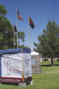
The Flags at the Willcox Wine Festival sign greeted you as you entered Railroad Park

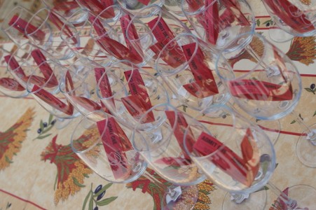
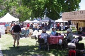
The Willcox Wine Festival was held on May 18th and 19th, 2013 at Railroad Park in downtown Willcox. For $15 you received a commemorative glass and eight tickers to allow you to sample wines of your choice. There were 16 wineries represented and they came from different parts of the state. We got to catch up with some of our friends from the wineries and also met some people that may become future guests at Down By The River B and B. The casual atmosphere at the wine festival allows you ample time to have some wine, listen to entertainment and enjoy the outdoors. The venue’s only drawback is that Railroad Park is, you guessed it, next to the Union Pacific main line and trains rumble by tooting their horn at the crossings. Fortunately this isn’t continuous nor does it last long.

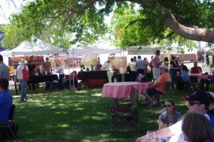
In addition to the wine tasting there are other local vendors that feature their wares at the Willcox Wine Festival. There were a variety of booths for you to visit and make purchases including, food, chocolate (chocolate goes good with red wine), nuts, art, jewelry to name a few. During both days of the festival there was live music by some good bands. So you can have a great day in the park doing different things. Bring a chair like we did. Then you can sit in the shade listen to the music and sip some wine that you can purchased from your favorite vintner. It can’t get much better than this!

Tickets and glass picture

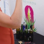
The Willcox Wine Festival sold tickets and a commemorative wine glass for $15.

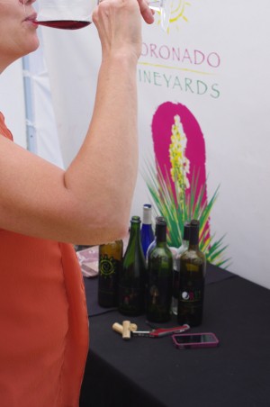
Angie and I were able to talk with Terry from Coronado and she told us that the new Cab would be bottled, hopefully in June. We were invited to do a barrel tasting of this wine in 2012 and it was excellent even then. It should be fantastic when bottled and be exceptional with a good steak. We also spent some time with Curt and Peggy from Laurence Dunaham Vineyards and with Kief from Kief Joshua. Rhona from Zapara Vineyards was in a booth next to Golden Rule and Coronado so we were able to talk with her a little before moving on to other tasting booths.

There is always something different at the Willcox Wine Festival and this year was no exception. There were two new wineries represented and we made sure to stop by. We always stop to check out wineries that are new to get an idea of what they have to offer.  One vintner was Rolling View / Saeculum Cellars. Dan had some nice wine and we did buy a bottle. The other is Flying Leap Vineyards. Flying Leap bought Canelo Hills in Sonoita from the Muellers. They are carrying the Canelo Hills wines but they do have some of their own. We only had one ticket left and so we didn’t get to sample all their offering. They have a tasting room in Sonoita and they also have just opened one in Willcox on Railroad Ave so we will get to know them a little better on our next trip.

Wine tasting Picture

One of the wineries we visited was Coronado Vineyards at the Willcox Wine Festival

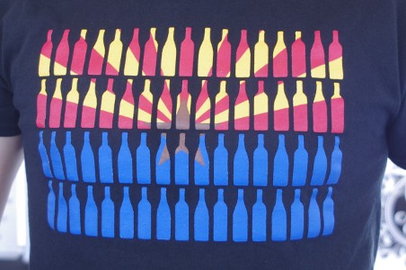
We also made a stop by Gallifant Cellars to touch base with Gavin, but he wasn’t there. He had misplaced his credit card slider for his phone and he was out looking for it. We didn’t get back there to find out if he found it.  The only other winery from Sonoita, other than Kief Joshua and Flying Leap, was Dos Cabezas WineWorks. We do like their wine but with limited tickets we wanted to sample ones we hadn’t tasted in a while. The Willcox area is where many of the vintners from the Cottonwood have their vineyards. Arizona Stronghold, Pillsbury Wine Company and Page Springs had booths and we don’t get much of a chance to sample their wines unless we head up toward the Flagstaff and Sedona locations. The other Willcox wineries were Carlson Creek (with their great T-Shirt design), Keeling Schaefer and Sand-Reckoner. Kokopelli Winery from Chandler was also at the festival.

Festival Booth Picture.

The Ticket booth is located at he main entry to the Willcox Wine Festival.

After doing our tastings, we wandered across the street to Rodney’s, our old standby restaurant. Although there was food in the park, we like to visit with Rodney since he makes the best catfish poor boys in Willcox. His gumbo is always good and it can be a tossup for me to choose which I want. This is good Southern Cooking and you can sit in the shade on the back patio to enjoy the food or take it back to the park. Rodney is always there, greets us with a smile and joke. The rail car on the corner of Railroad and Maley Streets is a restaurant for Big Tex BBQ but it is not open on Sundays. If you want to stay around the park, you are limited to food vendors at the festival, Big Tex or Rodney’s. There are other restaurants a short drive away.

Wine Booth Pictures

The Willcox Wine Festival booths of Arizona Stronghold, Kief Joshua and Gallifant were represented.

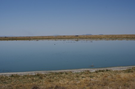
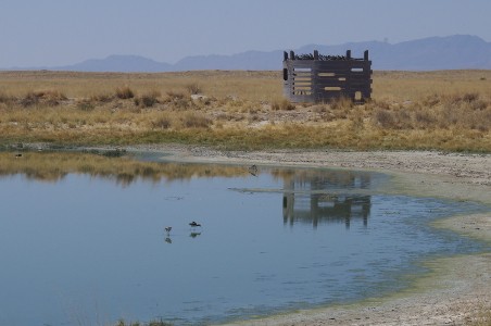
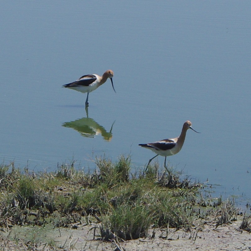
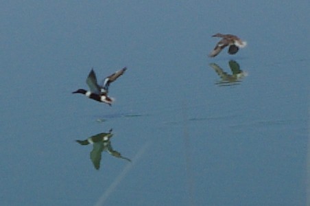
I have done blogs on the wineries in Willcox and Sonoita and you can read these if you wish. There will be another Willcox Wine Festival in October, on the 19th and 20th.  This is the same weekend as Helldorado Days in Tombstone. It is also near the end of the bird migration through the San Pedro River Valley. This will also be the first weekend that Kartchner Caverns will have The Big Room open for tours. So it will be a jam packed weekend of activities in Cochise County and there will many reasons for people to visit.  It ought to be a great weekend for you to join in on the fun and then to stay at Down By The River B and B, the Lodging Hub of Cochise County and have one of our outstanding breakfasts. You can take time to visit different events and stay at our centrally located B and B for the night. This lodging throughout Cochise County fills up quickly so make your plans now to make sure you are able to get your reservation before your chances are gone.

Railfoad park tree picture

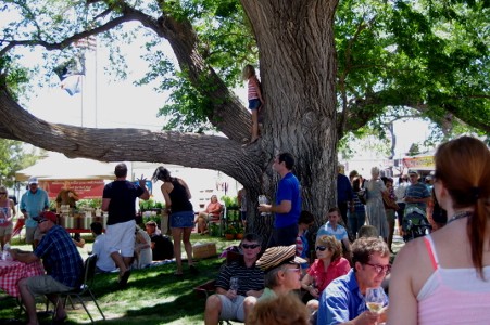
The giant cottonwood tree shade Railroad park during the Willcox Wine Festival

Music at the Festival Picture

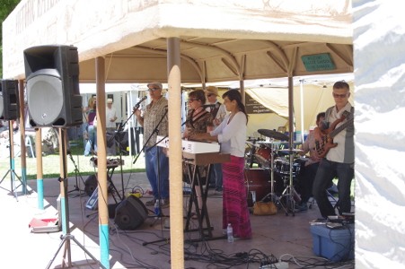
Live music is a feature at the Willcox Wine Festival held in May and October

Rex Allen Statue Pciture

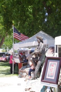
Railroad Park has a statue of Rex Allen and is the location of the Willcox Wine Festival
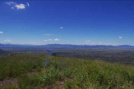
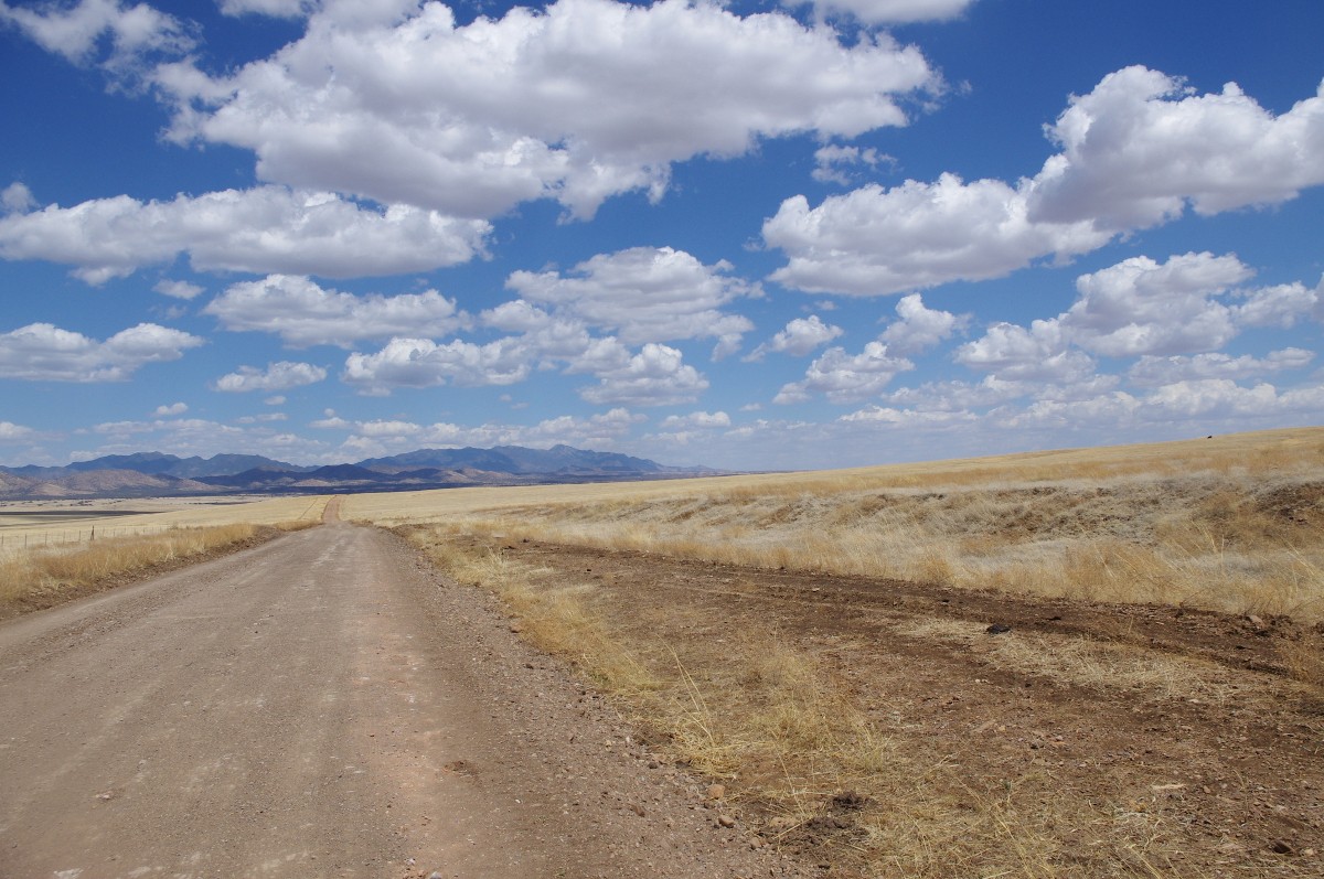
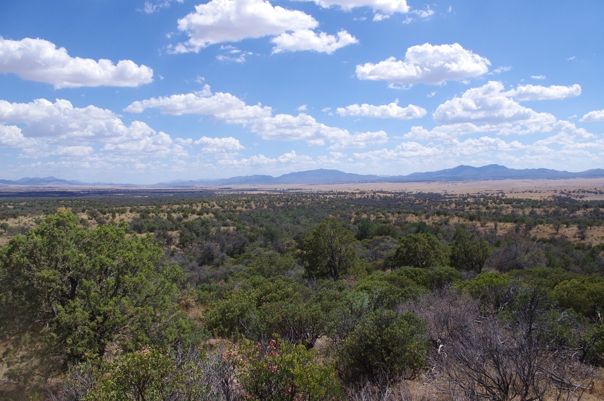
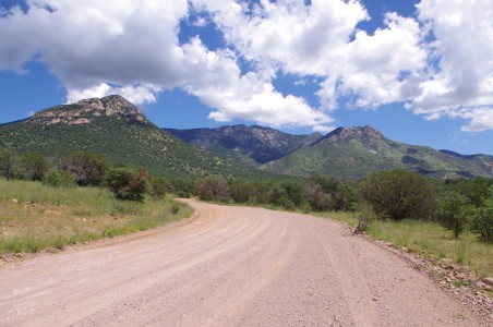
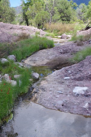
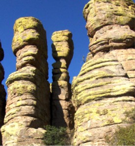
T Short Picture

The Willcox Wine Festival has more than wine. This T shirt is offered by Carlson Creek Winery.


  • Archives

  • Categories

»