Posts Tagged ‘Chircahuca National Monument’

Chiricahua National Monument After The Horseshoe Fire

October 30th, 2011 by Mike Hug

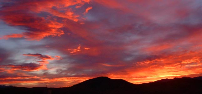
As you may have heard, Arizona was stricken by many fires. In particular, Southeastern Arizona had a lot of fires. There were many days at Down By The River B and B that the smoke was so bad it covered the area with smoke and made the sun an orange ball. Many people stayed indoors and some in the area with breathing problems left their homes, traveling to locations that weren’t affected by the fires.

Fire in Chiricahau National Monument

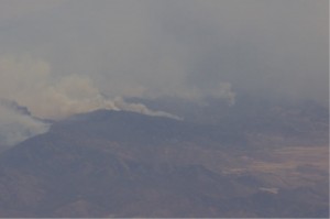
Horseshoe 2 Fire In The Chiricahua National Monument

In July, Angie and I were over by the Chiricahua National Monument and the park was closed at that time. During this last week in October, Angie, her friend Mary and I went to the Chiricahua National Monument to see what was burned, what was open and what structures were saved. We had hiked in that area about a year ago and I wrote on the blog what it was like.

Read the rest of this page »

Hiking In The Chiricahua National Monument

November 8th, 2010 by Mike Hug

Before I start talking about the trails, I would like to give you a little history of the Chiricahua National Monument. The Chiricahua National  Monument is located in the eastern part of Cochise County, Arizona near the New Mexico border, south of I-10. The Monument is relatively unknown to many people in the U.S. and even in many parts of New Mexico and Arizona. It encompasses almost 12,000 acres, much of which is designated as wilderness area. You can enjoy looking at the large variety of plants, reptiles, birds and mammals that the Monument has to offer. This part of Arizona went through a violent past that began about 27 million years ago when the Turkey Creek Volcano erupted and spewed ash up to 2000 feet deep over an area of 1200 square miles. The ash particles melted together to form rhyolite, a grayish colored rock that is what makes up the Monument today. Over the preceding years, the land was pushed up and the rhyolite cracked thus allowing water and ice to enter, breaking the rocks apart. Today the area is dotted with rock formations such as spires, balance rocks and other shapes.

Read the rest of this page »

  • Archives

  • Categories

»