Author Archive

Fort Bowie Ranger Lead Tours

February 16th, 2013 by Mike Hug

The following was just released today that the Rangers at Fort Bowie National Historic Site will lead tours on the weekends from February 23 until March 31. On Saturday a van will pick people up at the parking lot at 10:00 AM for a tour of the fort. There is a limit of 11 people for the tour so reservations are strongly suggested. There is a preliminary talk and then the tour of the ruins will take about 45 minutes. After the tour is finished, you can take the van back to the parking lot or you can hike out the mile and a half to the parking lot. The vans are handicap accessible as is the ruins at the fort.

On Sundays a guided ranger hikes will be available and will leave the parking lot at 10:00 AM. The hike will be along the trail to the fort. The trail is relatively flat most of the way and will focus on the events that ensued in establishing the fort. More information on the limited tours are available at the website on this special program or by calling 520-847-2500 x 1.

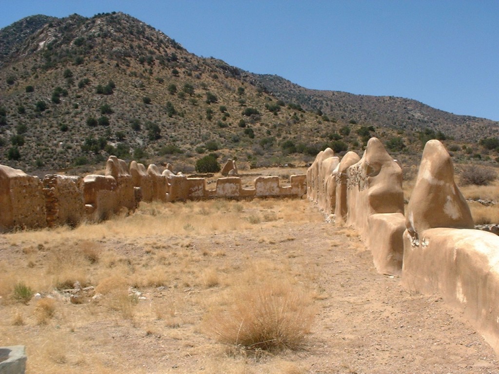
Fort Bowie Ruins Picture

The ruins of the quarters for the enlisted men is still visible.

The fort has a visitors center where you can look at many of the historical items in the display cases. There is old clothing and various military pieces for visitors to look at. I wrote about this hike in 2011 and you can read that blog by clicking here. Just a reminder hiking in the desert can be dangerous so take a hat and plenty of water when you hike. There is no food at the ranger station so take along something for a snack or a back pack with a picnic lunch. It is a fun hike so make the most of it.

The historic site is a short driving distance from Down By The River B and B in St. David, AZ.

Fort Bowie Overlook

Overlook of the ruins of Fort Bowie on the hills in the north side of the fort,

White Water Draw Part II

February 10th, 2013 by Mike Hug

This is Part 2 of my blog on White Water Draw. If you haven’t read about Part 1, click here.

Sand Hill Cranes in Field

The Sand Hill Cranes feed in the fields north of White Water Draw during the day.

When we arrived at White Water Draw, we were alone and I wondered why.  More than likely it was because it was cold outside and the smarter people decided to stay at home for a while. Well after we were at the barn another couple drove up so I figured ok it isn’t a holiday for the cranes after all. But I am digressing for those that read Part 1 so I will fast forward to about 10:45. Angie and I saw the cranes when we were near the Willcox Playa on our way to Cochise Stronghold for our hike. There is a corn field  that is located on the  side of the road that we were traveling on to the Stronghold Campgrounds.

Angie and I were on the levee and a few straggler cranes had flown over to land among the group that was about 100 yards/meters away from our location. When a new arrival flew in there was a chorus of honks until the new arrival landed then it quieted down. We had been informed that the cranes usually returned from feeding between 10:30 and 11:00. But it seemed that there were no birds in the air except a group of 3 or 4 or the singletons.

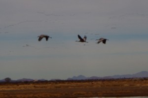
3 Sand Hill Cranes Returning

Three Sand Hill Cranes Arrive while others can be seen in flight returning to White Water Draw.

These birds were usually coming from the south and since I didn’t believe that there were any fields south of us I was wondering why they would come from that direction. Still don’t know unless they came from the southeast.

11:00 AM and Angie and I are on the platform at the water’s edge.  I am saving my battery then I see a small group of 7 fly in from the east. Battery on focus but the shot is not what I want so battery off. We are talking with other birders that have arrived and they were out of town from Illinois.  More people arrive on the platform including a couple of people that we had passed on the drive in. They were on bicycles when we passed them. We didn’t ask where they came from but it had to be from Tombstone, Sierra Vista area or Bisbee the closest being 30 miles. I don’t mind biking and I have done my share when I was younger and dumber on roads like Davis Road. Wouldn’t do it today it might leave a permanent dent in unseen places and not necessarily from my error. Now a tour bus arrives and the people are given their box lunches. Obviously someone knows about timing this better than I do. I think I should contact them to find out what the real facts are next time I plan a trip.

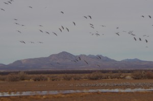
Sand Hill Cranes Returning Picture

When the Sand Hill Cranes arrive they come in waves.

It is 11:20 and still nothing. Now I am starting to wonder if this will be a bust. I figured we could go to 11:30, shoot these wonderful “National Geographic Shots” and then we would be traveling back to have lunch in a perfect world. But the birds are saying “I laugh at you!” We see all sorts of ducks, teals, plover, and the snipe less than 20 feet away. Great shots but do I waste the battery ….NO! I will kick myself later after I get home and charge the batteries. 11:25 arrives with more people on the platform but at least we are in front. I tell Angie we need to leave by 12:15 if there is no action.  We hadn’t brought any food and I figured by 12 we would be close to Bisbee and a quick lunch in the PERFECT WORLD.

It is 11:45 someone says they see some birds. I look north and see some irregular black lines in the air. But wait there are cranes down low coming into the lake area. The mountains behind them sort of hide them from view because they are similar in color.  As we looked we saw more and more. Now it is time to turn on the camera battery. The cranes on the ground seem to be

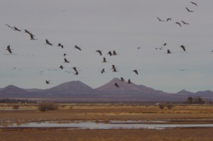
Sand Hill Cranes Returning Picture

After 20 minutes the cranes are still arriving at The Draw.

doing the chorus of greeting to the newcomers.  As wave after wave come in the birds land it different areas with some being closer about 50 yards away. This is really grand. The birds are doing a dance in the air as they find a place to land. At one time the birds converge at the point in front of us and flair out some to land and some to go to another location.  Focus click, focus click.  I am thinking if only I hadn’t made the mistake with the batteries and if I had my regular lens.  Que Sera Sera, Estupido!

12:00 brings more flights and I look to the horizon and see black strings of birds still on their way. Already thousands have landed and more are coming. The noise is pervasive and I remember that Barb had said that it almost sounded like something you would hear in prehistoric times. The birds keep coming and now that I have some shots that I feel are good I don’t want to waste shoot something that may not be as good as what was coming. This is a tragedy because if the batteries were good I would shoot until the memory card was full – maybe a thousand shots. That makes digital cameras so nice because you don’t have to process the film if it isn’t any good.

12:15 comes around and the black lines have lessened.  Now it seems like only stragglers are coming, so I ask Angie if we can go. We head back and to the car and on the way I take a shot back at the people that are still

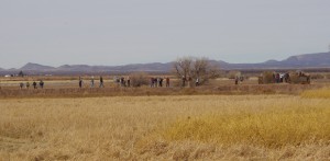
White Water Draw View Area Picture

Many birders come to see the action at White Water Draw. There is a large viewing area for people to watch.

there watching. The sun is starting to come out and I get a pretty good shot across the field with the automatic focus turned on. Amazing I still have batteries even though it tells me every once in a while that it is depleted.  We get in the car and head back home at about 12:40. As we are headed west on Davis road we watch another flight of Sand Hill Cranes with maybe 40 birds in it fly over us to the Draw. I see another group further on north coming. I would like to think that at that time the trip home would be uneventful but NOT! Davis Road was undergoing maintenance during the day and part was closed down and controlled by the highway department. You had to wait your turn and be piloted through. Unfortunately a van and a truck had an accident while following the pilot car but we weren’t involved.

There are at times an estimated 15 to 20 thousand cranes are at White Water Draw. My guess at the total population of birds in the area is close to 30 thousand during this time of the year. I have been here during the summer and late spring and found the area still to have birds but the water is pretty much gone. There are still some birds around but at a small fraction of what you see in December through March. Many of our guests at our San Pedro River B and B have no idea about White Water Draw. They have heard about the Willcox Playa from their birding friends but after they go to White Water Draw they fall in love with the place.

So if you are an amateur or an avid birder, consider visiting Cochise County in Southeastern Arizona and see what there is for you to see. When you come also realize that The San Pedro River B&B, Down By The River is central to all your birding activities and you will find that it is the Lodging Hub of Cochise County. Oh and as a reminder, make sure your camera equipment and batteries are in good repair.

White Water Draw Wildlife Area Part 1

February 4th, 2013 by Mike Hug


View Larger Map

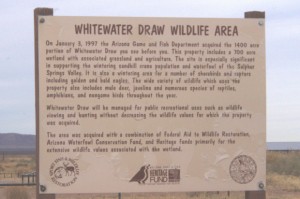
Sign Picture

The sign at the entry to White Water Draw tells you about the property

White Water Draw is a birder’s paradise during the late fall, winter and early spring. This place is located in Cochise County about an hour south and east of Down By The River B and B. The 1400 acre site has been owned by Arizona Game and Fish Department since 1997 when it was purchased from the Hyannis Cattle Company. About 700 acres is wetland and is known as a wintering area for Sand Hill Cranes and Snow Geese. After talking with guests Barb and I had gone to the area during the early spring after we had first opened the B & B 8 years ago.  Angie had never been there, so at the beginning of February we had a chance to sneak away for a couple of hours before our next guests were to arrive at the B & B for check in. We really were looking forward to this and I wanted to have the chance to get some good pictures of the action there.
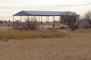
The Barn Picture

The Barn At White Water Draw Is Home To Owls

The cards seemed to be stacked against me as I gathered things together prior to making the trip. We didn’t have a great sunny day like we hoped to have, and the temperature that morning was cooler as we headed off. My one zoom lens that I always use for occasions like this had recently become disabled and wouldn’t focus so I had to improvise. I had some magnifiers that I could put onto the shorter camera lens and I hoped that doing this would work. I anticipated that I would not be as satisfied with the results between the overcast skies and the lack of my reliable zoom lens. But que sera sera as Doris Day once sang. Just gotta deal with the cards you’re dealt. Little did I know that the deck would be stacked against me in other ways I hadn’t thought of.
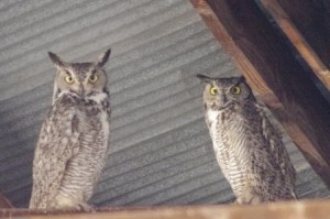
Great Horned Owls  Picture

Great Horned Owls Can Be Found In The Barn At White Water Draw.

The drive to White Water Draw is about 50 miles and takes under an hour. We headed to Tombstone and drove through town. After a few miles Davis road was on our left and we took it to just after milepost 21. We turned right on to a dirt road named Coffman Road. The road sign wasn’t there but there is a sign for White Water Draw on the road. After about 2 miles we came to the parking area. It was still overcast and cold; so we bundled up and walked over to the barn that sits on the site. “The Barn” is about 30 foot tall and there usually are Barn Owls and Great Horned Owls roosting in it. One owl was there instead of the customary pair. After taking some pictures and saying “How Do” we walked on over to the viewing area to check out what was going on with the cranes and other denizens of the wetlands.
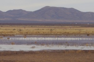
Snow Geese Picture

Snow Geese On The Water

Besides the Sand Hill Cranes and Snow Geese, the area is frequented by many other birds and water fowl. These include Blue-Winged, Green-Winged and Cinnamon Teals, Northern Shovelers, Western and Clark’s Grebes, Mallards, Egrets, Great Blue Heron and many others. The area has many raptors including Northern Harriers and Swainson Hawks. During my previous visits I have spotted Phoebes, different types of Sparrows, Yellow Headed and Redwing Blackbirds, and Vermillion Flycatchers to name a few. It is a good place to see a large concentration of different birds in a small area.
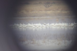
Snow Geese Picture

Snow Geese As Seen Through The Magnifiers

As we walked along the levee, we came to one of the viewing platforms constructed at the water’s edge. The platform has free for use, large magnifying glasses that you can use to look at the birds. While at the viewing platform, we saw a Loggerhead Shrike right below us. He was camera shy. Every time I tried to get the shot, he would hear the camera focus quickly duck into the reeds and become almost invisible.  I noticed the Snow Geese and shot some pictures of them grouped on the water. After my shot, I looked through the glasses that were provided to see them better. It was much better than my lens. Then I thought that maybe I could get a shot through the magnifier to get an idea of a comparison of my lens to the viewer. It wasn’t a real sharp picture because I was attempting to focus through another optical instrument. I was semi successful and you can see in comparing the two pictures it does give you an idea of what the magnifiers can do.
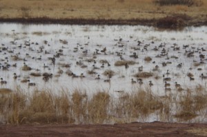
Water Foul Picture

Ducks And Other Water Foul Fill One Of The Ponds

We moved further along the levee and came to the next pond that contained a lot of ducks. We startled them when we walked up to the edge and they saw us. They all took flight and landed a little further away. It would have been a great shot had I known that the ducks were there and been ready for them. But by the time I got the camera on the birds they had gotten settled a little further from shore. There was a multitude of water fowl in the group. It was fun to watch them feed, with tails up in some cases, and others like the Shovelers just put their heads down with the long beaks to root around in the mud.
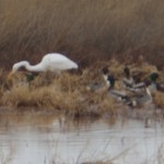
Egret Picture

Egret Hunting

A little further along, I took some time to check out an Egret that was feeding in the reeds. They exhibit a lot of stealth and wait for the fish to come to them. With a quick move he had a fish but I was so mesmerized by watching what he was doing that I forgot to click the camera and I missed the shot. Not the first time that I have missed pictures because I’m concentrating on what I am viewing. I have to get over that since I can see the action later if I take the picture when I should.

Over the fields to the west we saw some Northern Harriers gliding over the grasslands.  It is a beautiful sight to see these birds gliding through the air. It reminded me of the time last summer when I saw the Harrier that frequented our San Pedro River B & B and how I finally got a series of pictures of the Harrier in flight. But as I watched, the
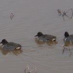
Green Winged Teal Picture

Green Winged Teal Were Out in Plain ViewGreen Winged Teal Were Out in Plain View

Harrier changed paths and flew toward the Snow Geese. In an instant they were up in the air and scattering out of the way. Again, camera down and batteries off so I didn’t get a shot again. You think I would learn this lesson but in the long run it was probably best that I didn’t walk around with the camera always on. While the geese were flying in a circuit, I tried to focus on them as they flew toward us and the automatic focus just wasn’t cooperating. I did get some nice pictures of the gray sky. By the time I had them in focus again they were landing back in the water where they had started.

About this time my battery started telling me that it was getting depleted. Ok, not to worry I always have the spare in the camera case, so I stopped to change to the recharged battery. I put it in and found that it had less of a charge than the one that I had just had in the camera. “DOH!” as Homer Simpson would say.  I forgot to charge it after our walk around Texas Canyon and then our hike to Cochise Stronghold.
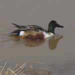
Northern Shoveler Picture

Northern Shoveler Can Be Found Here At White Water Draw.

Now I am in a bind. One battery with one anode in the grave and the other already 6’ under raising daisies! OK, I ask myself, what takes most of the energy to run the camera? Number one is the autofocus. So I put things on manual focus but this really is not the best for what I want to do with the pictures. The manual focus depends more on your eyesight determining what is in focus and what isn’t. Not bad if it is bright out or if you don’t intend to enlarge the picture later. Both conditions will make it more likely for a picture to be blurred. Mas que sera para mi! I don’t have a lot of choices if I want to have pictures.

So what happened? Well, you will have to wait to read about this misadventure in Part 2 of this blog where I will be talking about watching the Sand Hill Cranes come in from feeding in the fields. Consider staying at a Southeastern Arizona B and B with easy access to a lot of Birding in Cochise County. The San Pedro River B&B is located at the northern end of the San Pedro River National Riparian Conservation Area between Benson and Tombstone.
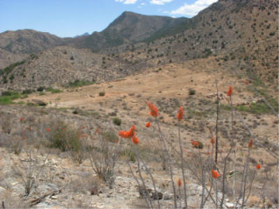
Explore Texas Canyon in Cochise County

January 28th, 2013 by Mike Hug

Texas Canyon Pic

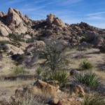
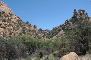
Texas Canyon Back Country Rock Formation

As you drive on Interstate 10 through the Little Dragoon Mountains about 15 miles east of Benson you will find an area that is in stark contrast to the San Pedro River Valley. Texas Canyon is a massive granite formation that has weathered over the eons to create a jumble of rocks that catch the eye. The granite formation can be seen as you drive past on the interstate or when you stop at the rest areas. The rest area gives you some nice views of the rock pillars and boulders but you are fenced in and you can’t really get out to explore the area. If you take exit 318 you will be able to find some spots to wander around and see a little of what is here.

When Barb and I were first coming to southeastern Arizona looking for a location to build Down By The River B and B, we drove through Texas Canyon. We would often think how fantastic the rock structures were in this area. We wished that we could have moved some of this area to Saint David and placed it along the San Pedro River right next to the BnB but alas it was 25 miles away.  The rocks are scattered over a large area and it almost looks like some giant was playing with them and then just left after he was done.

Texas Canyon Picture

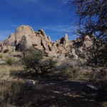
Texas Canyon scattered trees offers some shade while you enjoy the views

During the eight years the b and b has been opened, we have traveled past or through Texas Canyon on our way to somewhere else. Usually we have taken the turn off to go to the Amerind Foundation Museum, The Triangle T Ranch for dinner in the saloon, or just to take a shortcut to Arizona 191 on our way to various places in the Sulphur Springs Valley. We never took the time to stop and see what the back country was like.

Recently, Angie and I decided to take a short day trip from Down By The River B and B to Sunsites and head  to the trail head for a hike up to Cochise’s Stronghold in the Dragoon Mountains. Naturally I was going through Texas Canyon as we exited the freeway on Dragoon Mountain Rd. But instead of making the turn and driving on to our destination, I decided to take some time to see what I had been missing. I turned left under the freeway and took 4Y Ranch Road into the back country north of the freeway. The one lane road doesn’t go far, maybe a mile, and you finally reach  the cattle guard and the ranch gate.

Texas Canyon Valley Picture

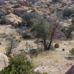
Texas canyon has some valleys that drop that will beg you to explore them

We backtracked a little and found a place to get off the road. With a nice morning sun, we decided to walk around and see what the area had to offer. It turned out that long with the enticing rock formations, the area has yucca, ocotillo, cactus of various sorts and scattered trees that dot the terrain. We also saw signs of coyote, deer and the occasional bird that fled our advance. On previous travels though the area I have various seen birds fly across the road and I have spotted hawks that are watching for prey. But since this is winter, I didn’t expect to see a lot of activity.

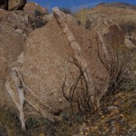
As we walked around the area we notice the rocks were crossed by thinner lines of a different type of lighter colored material. At first I thought that since this area was a shallow sea way back in prehistoric times that these strata I was seeing in the rock were probably layered like sandstone and then hardened. My originalthesis turned out to be wrong. After investigating, we later learned that this entire area was formed about 50 million years ago when magma pooled below the surface of the earth and

Boulder Picture

There are rounded rocks in Texas Canyon that are layered with strata.

slowly cooled forming the rocks geologists call quarts monzonite. The strips of fine grain material is actually called Aplite and it is formed during the granite formation process. Unlike the Chiricahua Mountains the area never became an explosive volcano since the magma never reached the surface of the earth. Over the years the earths surface eroded away and left the rocks. Weathering from wind and the freeze thaw cycle started breaking the rocks down and rounding the corners giving the rocks spheroid shapes. As the softer rock was worn away the denser rock would sometime be sitting on the small support underneath and you get the proverbial “Balanced Rock”.

After the geology lesson, come on forward to the more modern times and I will tell you more about who inhabited Texas Canyon. The area has been found to to contain petroglyphs and pictographs on the boulders and was the area was sacred to the Native American inhabitants. I can see why that was because it is awe inspiring when you are amongst the boulders. Cochise is said to have used this area for his winter camps. In 1858, the Butterfield Stage Route ran through Texas Canyon on its way to Benson after leaving Apache Springs near Fort Bowie in the Chiricahua Mountains. The stagecoach line was awarded the mail contract from the US Government and carried mail and passengers from Saint Louis, MO to San Francisco. The stageline lasted until the start of the Civil War when the troops were withdrawn to fight in the war. With no military protection from the Apaches, the stage route was abandon. The area was controlled by Cochise and his Chiricahua Apaches until he made peace with the US in the 1870s. In the late 1880s David Adams settled in the area. He was from Coleman County Texas and he was followed by his brother William in 1895. Over the years

Texas Canyon Cemetary Panel Picture

Texas Canyon Pioneer Cemetery information panel. Click the picture to enlarge

other family members followed the brothers and settled in the area. It became known as Texas Canyon because of all the Texans that lived up there. The Adams family cemetery is located on the Amerind Foundation grounds along the road that leads into the museum parking lot.

There are a couple of places in Texas Canyon that need to be mentioned. In 1927, the Triangle T Ranch got its name from the new owner Metta Tutt. The ranch became a dude ranch and later was used to house the Japanese Diplomats during World War II.  Parts of the ranch have been used as movie sets including the original 3:10 to Yuma with Glenn Ford and Tombstone. The television production Young Guns also used the property as a set. Other pictures have been made in the area and notable people have visited the place. Just a little further south is the location of the Amerind Foundation. In the 1930s William Shirley Fulton established The Amerind Foundation in the canyon where he was doing archeological digs. The Museum features much of what was found in the area along with artifacts from Mexico and South American cultures. The Foundation is celebrating it’s 75th Anniversary.
This gives you some of the highlights of the area and it is a short 30 minute trip from the Down By The River, The Lodging Hub of Cochise County. I will be doing some more blogging on the Amerind Museum and what you can see when you visit. We have seen birds in the area but probably one of the strangest things I have seen at the Amerind was the vultures that were flying up into the tall trees to roost toward the end of the day. Naturally I didn’t have my camera with me for that shot. I still need to jog my memory to bring a camera when I am going places. It never happens to fail – there is always a great shot when I don’t have the camera. You think I would learn.

Birding Areas Near Down By The River B and B

January 20th, 2013 by Mike Hug

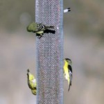
Gold finch at feeder

Lesser Goldfinch and Warblers love to visit the feeders

Birding is one of the many things to do in Southeastern Arizona, in particular Cochise County, and our B&B is near to all these locations. In fact there is a path to the San Pedro River that is right out the back door of our BnB. The B and B is located on the west side of the tree lined San Pedro River away from the noise of Highway 80. We keep most of the 15 plus acres of the property natural so that the wildlife has shelter and food sources. We do keep feeders for the birds and the resident birds frequent them. Many finches, sparrows, doves and quail frequent the feeders during the day. During the spring summer and fall the hummingbirds are always around to grab a sip of nectar. There are the territorial hummingbirds that run the others off but once in a while a hummingbird will hold it ground and fight. If you want to get up close and personal, sit in a chair on the patio, sip some wine and  wear some read ear rings. You may hear a hum next to your ear. turn slowly as it will probably be a hummingbird looking for a drink.

We do get the Raptors at times that come over the field on the hunt. I did do a blog on a Northern Harrier that

Northern Harrier Picture

Northern Harrier flies low over the back acreage looking for prey.

spent most of the spring gliding over the property. He was back again in the fall and we see him every once in a while this winter. In the mornings and afternoons during the spring we have some American Kestrels that show up and hover over the fields. It is fun to watch them dive down for a morsel and fly back up to a limb and then repeat the cycle. We do have Red Tail Hawks in the area but last summer we had something larger. It took a while but I got a long shot at the bird sitting on a limb of a tree at the river. After walking toward the tree I saw how big the limb was and my best guess along with some other birders that were here was that we had spotted a golden eagle. We saw that bird many times over the summer. Just after the New Year we were coming home late at night and an owl took flight from a pole as we came around the corner. We couldn’t tell what type but there have been Great Horned Owls seen at the San Pedro by Angie and me last summer. Check out this list we have of birds that have been spotted on the property.

Vermillion flycatcher picture

Vermillion Flycatchers are found in the San Pedro River area and on the property of Down By The River B and B in St.. David.

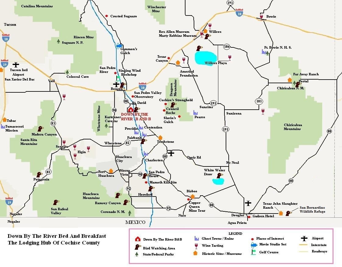
There are other locale areas that are near the bnb in Benson and St. David. Benson has a birding trail that is near the waste water plant along the San Pedro River. This can be reached by heading north on Ocotillo Road at the corner where Safeway is located. Go under the I – 10 freeway and turn right at the sign for the San Pedro Valley Golf Course. Turn left at the T and follow the road to the waste water plant. The other local area is the Holy Trinity Monastery that is about 1/2 mile north of the B and B on the east side of the river. The Monastery has an award winning birding trail that was dedicated in 1993 that starts on their property. The Monastery also has pond and 150 acres of open area adjacent to the tree lined river. There is also a trail south of St. David along the San Pedro River at Fairbanks. This trail is wooded and goes back to the ghost town of Contention. For other birding areas click here for a list of locations and then reference the map below to get a perspective of distance from the B & B.

It has been a bit on the cold side in Arizona over the last week and so the birds are really hitting the feeders. It

Black-chin picture

Black-chinned Hummingbird taken by our guest Egil from Norway.

seems that the year is moving along relatively fast for us. Christmas came and went and now we are half way through January. The birds will start migrating back through the area in March and April. In April of 2008, we had a birder that spent three days at the b and b either on the porch or with occasional walks to the river and sited 53 birds. She was very excited that she could find such a large population in such a small area. I was amazed that she could identify that many birds in such a short time. Migration isn’t too far off and we have future guests that have already made their reservations for that time of the year. Check out our list of the birds that have been seen on the property and at the San Pedro River that flows behind the property.  Come join us and see what we have to offer. We are centrally located so that trips to other birding areas are close by.  We just updated the map. Please right click on the map below and click on view image to get the full size map and you can see what I mean.

Cochise County Map

Down By The River B and B is “The Lodging Hub of Cochise County” and you can see all the things to do in the area from this map

Bird Watching In Cochise County

January 15th, 2013 by Mike Hug

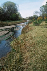
San Pedro River

The San Pedro as it leaves the northern boundary of the San Pedro National Riparian Conservation Area

Some of the best birding in the United States is found in Cochise County. There are locations in the County from the sky islands to the San Pedro River that have great birding at different times through out the year. Approximately 400 species of birds can be found with approximately 250 that use the San Pedro River on their migration in the spring and fall. The San Pedro River is the last free flowing river in Arizona. It flows all year around and originates in Mexico, flows north through St. David and Benson to end at the Gila River in the near Superior and Globe. Depending upon the time of the year the river may not be surface water north of Saint David but will become an underground river. The San Pedro National Riparian Conservation Area encompasses the San Pedro River from the Mexican border to the south end of Saint David. At the northern end of the San Pedro National Riparian Conservation Area is the location of Down By The River B and B a centrally located San Pedro River BnB with access to the San Pedro River and the great birding that can be found there.

Birds also use various locations in the county to stay the winter. A good example is the Sulphur Springs Valley, where the Sand Hill Cranes winter at White Water Draw and at the Willcox Playa. Other water birds are at these locations during the winter. These two areas have large areas of water during the winter but in the summer the lakes are small if there at all. During the winter at White Water Draw you will find raptors including owls that inhabit an old barn  that is on the site. As spring weather comes so do the flycatchers.

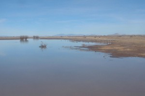
White Water Draw Picture

Thousands of San Hill Cranes, along with other birds, winter in White Water Draw.

The sky islands of the Huachuca, Dragoon, Mule and Chiricahua Mountains all have different birding areas. The foothills going to these locations will also have birding opportunities. During the winter, some of these areas may be closed or restricted due to snow. The sky islands have peaks from 8,000 to over 10,000 feet in elevation. In certain areas access can be with by a normal car but some of the back country treks need a high clearance vehicle.

Birding can be done throughout the year in this area with different venue that become available during the different seasons. So if you are an avid birder or are just starting out learning about birding,

Dragoon Mountains

The Dragoon Mountains offer many opportunities for birding and hiking.

Cochise County offers a lot for all types of birding enthusiasts. Down By The River B & B is also known as the Lodging Hub of Cochise County and offers you a great place to stay while enjoying your time bird watching. Try us out and see what we have to offer. You won’t be disappointed.

Read Old Tombstone Newspaper Stories

January 4th, 2013 by Mike Hug

Back in April 2012 I wrote a piece concerning Tombstone near, our B&B, about the Tombstone Archives. The Archives have a lot of items and papers in their possession about the town of Tombstone. However they don’t have the day to day happenings of the town. A little more research is needed for that.
OK Corral article

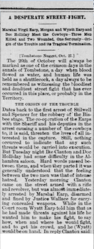
Partial article written in 1881 about the shootout at the OK Corral

Recently our friend Bob, who works at the Benson Visitors Center, showed me a website that opens up a whole new way to find out information. The website is from the Library of Congress and it has many newspapers from all over the United States with copies that range from 1836 to 1922. Not all the newspapers nor all the issues of a newspaper are there but you can search for names, events or just what was reported on a certain date in a certain town or state. They may not show up in the specific paper that you think would have the information but may be in others.

Now just about everyone who has knowledge of the Old West knows that there was a shoot out at the OK Corral. Tombstone, the gunfight and Wyatt Earp have been glorified in many movies, TV shows and books over the years. But have you ever seen a written account from that time period that gives you the newspaper report? I hadn’t seen one until I did the search of the Library of Congress website. On the website I found a long article about what happened and what led up to the fight. The article is a copy of the one written up in the Tombstone Nugget which was a daily paper that was printed in Tombstone during that time period. The article was reprinted in a Tucson paper, The Arizona Weekly Citizen, on October 30 1881 4 days after the shoot out happened. I have copied a portion of the article here but if you would like go read the article in the Citizen then  click on the link. The article is at the start of the seventh column.

Now if you want to visit Tombstone you should consider where you are going to stay. There are many things to see in Tombstone including the Graveyard at Boot Hill where the McLaurys and Clanton are buried. Spend the day and watch the gunfight reenactment at 2 PM daily. Down By The River B and B is less than a half hour drive to Tombstone. The San Pedro River BnB is centrally located to many different historical locations, birding sites, wineries and also State Parks and National Monuments. For a peaceful and relaxing stay visit our website and see what great destination Down By The River B&B is for your lodging experience.
San Xavier Mission – Part of a Loop Trip

December 28th, 2012 by Mike Hug

San Xavier del Bac

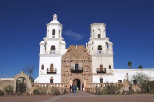
San Xavier del Bac Mission

Down By The River B&B is centrally  located for various day trips to places throughout SE AZ. The San Pedro River B and B Lodging is perfect for loop trips to see this part of Southern Arizona. One all day loop trip we like to make is driving to Tucson and then taking Interstate 19 south with a stop at San Xavier Mission, then on to Tubac. Leaving Tubac head south to Nogales with a possible stop at Tumacocori Mission State Park on the way. At Nogales take Highway 82 east to Patagonia and finally stop at Sonoita and Elgin to do a little wine tasting. From here we take 82 east as we head on home. This loop trip can be done in reverse or it can be a detour on the way to or returning from our southeastern Arizona BnB.There are even some alternates that can be used to shorten the loop.

There are people that have never heard of the San Xavier del Bac Mission, or White Dove of the Desert as it is also called. Some people have stopped and some others may have seen it in the distance as they traveled on Interstate 19. I first saw in the 1970s when I came to Arizona. Barb was there during the restoration and saw the work that was being done. So I am going to tell you a little about this landmark when you make this loop trip. Each year 200,000 people from all over the world stop to view the finest example of Spanish Colonial architecture in the United States.

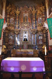
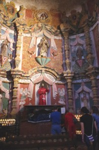
San Xavier Altar Picture

The Main Altar

The history of the mission started in 1692. Father Eusebio Kino, a Jesuit missionary, established the San Xavier Mission just south of present day Tucson at the Tohono O’odham Village of Wa:k. That is spelled correctly. The church was named after the patron saint San Francisco Xavier, pronounced ”Havier”, “del” is Spanish for of the, and the word “Bac” comes from the way Father Kino wrote down the word Wa;k.  Visits by missionaries to the village were sporadic until finally in 1752 the first church building construction was started under the tutelage of Father Espinosa. This church still stands adjacent to the east side bell tower. The building now houses the museum and gift shop. The actual construction of the large church began in 1783 and was completed in 1797 under the Franciscan missionary Father Velderrain. Father Velderrain accomplished this with the help of the village population and monetary loan of a wealthy rancher in the State of Sonora in present day Mexico.

The mission has been under many jurisdictions since it was established. Originally, this part of Arizona was under the authority of New Spain. When the Mexican people gained independence in 1821, San Xavier became part of Mexico.

Last Supper Mural

Last Supper Mural

With the Gadsden Purchase of 1854, the Mission joined the United States as part of the New Mexico Territory. The territory was later split and San Xavier became part of the Arizona Territory and then in 1912 the territory became a state. As to the Catholic Churches jurisdiction; San Xavier was in the Diocese of Durango when the mission was first established. It changed to be a part of the Diocese of Santa Fe when it was established in 1859. In 1866 Tucson became a diocese and regular services were again held at the Mission. A school was started at the Mission in 1872 by Franciscan nuns. In 1963, The Mission was listed as a National Historic Landmark and it has the distinction of being the oldest intact European structure in Arizona.

 The original construction was made with low-fire clay brick, stone and lime mortar, the entire structure is

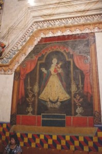
Lady Of Guadalupe Picture

Lady Of Guadalupe

roofed with masonry soaring vaults, which is not found in any other Spanish Colonial buildings within the United States. The artwork and decorations on the interior of the church are from unknown artisans. The belief is that they were from Queretero and were created in guild workshops and then transported to the mission by pack animals. After being placed in the church then local craftsman finished the work using gesso, a gypsum product, and then adding paint. The Franciscan Cord can be found throughout the interior and exterior of the church. There are many mural paintings and statues throughout the mission

 Over the years the mission started to deteriorate through normal wear and tear and in 1859 the first repairs were made to the church. In 1887, an estimated 7.6 earthquake in Mexico damaged the mission. This earthquake was about 60 mile south of Douglas, AZ and was felt up to 120 miles away. The quake also changed the flow of the San Pedro River and you can read what the Tombstone paper wrote about the earthquake here.  In 1905  Bishop Granjon began

East Side Chapel

East Side Chapel

major repairs on the mission and again more restoration was done in 1939 after a lightning strike affected the west tower. Cement was one of the repair materials used during these times. As it turns out this would later cause more damage to the artwork on the interior of the church.

In 1989, excessive leaks were found in the walls and forced emergency restoration. Major conservation began in 1992 with a five year effort to preserve the interior of the building. I remember seeing the building in the late 1970’s. The murals and statues looked worn and drab. This was caused by all the years of candles being burned in the church. Because of the smoke and water damage the work was critical to maintain the artwork. There is an ongoing effort to preserve the church when the money is available. Funding sources have been harder to get due to budgetary restrictions by grant and state organizations. To help with the preservation of the Mission, a group of community leaders formed the Patronanto San Xavier in 1978. You can read about their efforts on their website.

To reach the Mission drive south on Interstate 19 about 9 miles, take exit 92 (San Xavier Road) and follow

West Side Chapel

West Side Chapel

signs to the Mission. Visiting the Mission San Xavier is free of charge. During the year there are special events that are held at the mission.  It is definitely worth your time to take a look at a part of history that help to shape this part of the Southwest. This mission and Tumacocori are the inspirations for us to name one of our guest rooms the Mission Room.

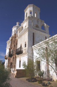
San Xavier Side View

San Xavier Side View

Willcox Wine Region of Cochise County

December 14th, 2012 by Mike Hug

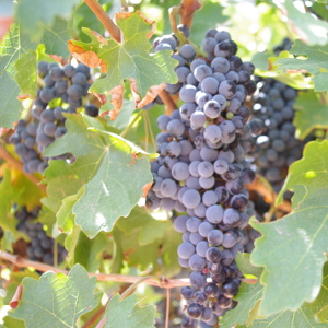
Grapes on the Vine Picture

Petit Syrah Grapes on the Vine at LDV

Down By The River Bed and Breakfast is centrally located to many attractions in Cochise County and in particular to the two wine regions here in this part of Arizona. That is why we are recognized by our guests as the “Lodging Hub of Cochise County“. The last blog was about the Sonoita area wineries and how they are working with the Knights of Columbus Charity Golf tournament. The golf tournament proceeds go to the University of Arizona Cancer Research Center and to a High School Scholarship fund for graduating seniors. This is the 7th Annual event and Down By The River B and B is one of the sponsors for this golf tournament. You can read about the special we are offering for guests that “Stay n Play” during that weekend at the bnb. After that blog was published Angie and I went over to the other wine region here in Southeastern Arizona and visited a few of the wineries in this part Cochise County. Actually many of the grapes that are processed for the tasting rooms in the Cottonwood area are grown in the Willcox – Sulphur Springs Valley. Many of the wineries help us out with the charity tournament over the years and we are most grateful.

We started our trek by heading to Zarpara Winery. They are located in Kansas Settlement, south of Willcox but we took a short cut through Texas Canyon and got off the Interstate to save some time. This route takes us past the Amerind Foundation which is a wonderful museum that was established in 1937. I will talk about it in a future blog. So back to what I was originally talking about.

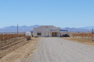
Zarpara Picture

Zarpara Tasting Room is in the middle of the vineyard

Zarpara Vineyards has only been open since January. The tasting room is located in the middle of the vineyard and it must be beautiful during the summer with all the grapes hanging from the vines. We were there in December when the leaves have fallen and the plants are dormant. The nice thing about Zarpara is that the owners Rhona and Mark are there to greet you as you come in the door. Besides their own wines, the tasting room also has 5 other wineries that they represent. They have wines from Sierra Bonita in Graham County north of Cochise County, Gold Rule Vineyards, Sand-Reckoner, Arizona Stronghold and Gallifant. They don’t’ have tastings of all of these but we did get to sample a few and found many to our liking. We did leave a little lighter in the back pocket at the end of the tasting. Zarpara has agreed to be a T Box sponsor this year for the tournament.

Keeling Schaefer Tasting Room

Keeling Schaefer Tasting Room is in down town Willcox

We then drove into Willcox and our next stop was in the downtown area where Keeling-Schaefer and Carlson Creek have their tasting rooms. The downtown area of Willcox is home to the Marty Robbins Museum and the Rex Allen Museum. Carlson Creek’s tasting room is on the south side of the railroad tracks.  Keeling-Schaefer is on the north side right across from the Railroad Park where The Willcox Wine Festivals are held in May and October. Check out our events page for the dates of these events. Both of these wineries have some great wines and if you park at one location you can walk to the other. The owners weren’t there but again we were greeted by hostesses who were very knowledgeable about their product and thus enhanced our experience. We also took some time to stop by our friend Rodney at his Cajun-style restaurant near the museums. Rodney serves some great catfish sandwiches and we also like the gumbo. Big Tex Barbeque is also nearby. The restaurant serves barbeque pork, brisket and chicken to name a few things and it is located in a train car at the intersection of Railroad Avenue and Maley St. (Route 186). Try it during the week or Saturdays but they aren’t open on Sundays.

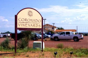
Our last stop was at Coronado Vineyards located on the east side of Willcox. Coronado has been a sponsor of the golf tournament almost from the start. We enjoy going to see Terry and Jacque when we get to Willcox. Coronado has a kitchen and at certain times will serve items while you are tasting wine, thus giving you a Coronado Winery Enterancechance to pair food to wine. This is a nice concept and you can see how the food and the wine blend to make your tasting so much more enjoyable.

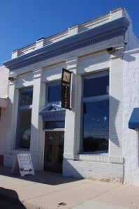
We didn’t get to the Laurence Dunham Vineyards because Curt and Peggy were up in the Fountain Hills tasting room and they were getting ready for their Christmas Event. The winery and tasting room in Cochise County is south in the area of the Chiricahua National Monument and they do events at various times of the year also. LDV was a T Box sponsor last year for our tournament. Another winery we didn’t get to because of time and distance was the Bowie Winery in Bowie, AZ. This tasting room is about 20 miles east of Willcox at the town of Bowie. If you go to the Fort Bowie Historical Site then you are close to the tasting room. After hiking at Fort Bowie you may consider taking a break and stopping for  a little wine tasting. They also have pistachios and pecans for sale.
Now you have heard about both of the Southeastern Arizona wine regions and have been told about the central Arizona wineries Cochise County connection. So plan your visit to take in some of what the wineries have to offer and when you do thank them for their civic contributions to the charities that they work with. If you are looking for a wine country b&b, then consider that you want to find a nice place to stay during your visit and reserve your room at Down By The River B and B for a comfortable stay and wonderful breakfasts.

Sonoita Area Wineries

December 11th, 2012 by Mike Hug

Down By The River Bed and Breakfast is centrally located to many attractions and because of this we are short

Arizona Prize Wines

Arizona Wines Are Prize Winners

distances throughout Cochise County and parts of Santa Cruz County. That is why we are known as the Lodging Hub of Cochise County“. Southeastern Arizona is known for birding and more recently wine tasting. SE Arizona has some of the best of both of these pasttimes and Down By The River BnB is close to both with birds out our back door at the river and the wine regions of Sonoita and Willcox a short drive. Some of our birdwatching guests have told us that a B&B with wine tasting nearby is the perfect fit for their adventure.
Angie and I took a little time to go to the Sonoita area wineries to ask the vintners to again  be sponsors for a Charity Golf Tournament. We wanted to let them know about the Knights of Columbus Marie Lovell/ Barbara Hug/ Paul Padia Memorial Golf Tournament that will be held on February 23, 2013. Yes this is the Barbara that started the B and B with Mike. The tournament proceeds go to the University of Arizona Cancer Research Center and to a High School Scholarship

Charron Patio

Charron Vineyards allows you to sit on the patio and overlook the vines while you sample the wine.

fund for graduating seniors. This is the 7th Annual event and Down By The River B and B is one of the sponsors for this golf tournament. You can read about the special we are offering for guests that “Stay n Play” during that weekend.
Many of the wineries help us out with the charity tournament over the years and we are most grateful. Mike was lucky enough to win a free wine tasting in the raffle last year so we were able to do some wine tasting at the same time. We also took some time to go to the Willcox area wineries to talk with the different vintners about sponsorships. We will discuss that in a blog next week.
We didn’t get to all the wineries in Sonoita but we did get to stop at 8 of 11 tasting rooms. We took time to enjoy the conversation with the people that were wine tasting and got re-acquainted with many of our vintner friends. Angie and I have always found that wine

Oak casks at Dos Cabezas Winery

At Dos Cabezas you can walk into the store room where they wine is stored in oak casks.

people are usually happy and like to talk to each other. You get to know something about them as they tell you about places that they have been where they took time to taste wine. You can put that in the back of your mind for later use if you plan to travel to another area of the country.
Because some of the wineries are only open on weekends, we chose a weekend to make our loop trip. We started our tour by taking I-10 to Vail and then Arizona 83 south to make our first stop at Charron Vineyards. We were able to talk with Susan and a little with Milton while viewing the area off the porch at the tasting room.
We continued down 83 to Sonoita but the next two places we stopped at the owners were at a wine festival in Phoenix so we didn’t get to talk with them. one of these wineries was Dos Cabezas near the

Hops & Vines Picture

Hops and Vines has recently opened and intends to be a microbrewery along with being a winery

intersection of Arizona 82 and 83. After some discussion with the staff people and customers there we headed east on 82 to Hops and Vines.
Hops and Vines may end up being a little unique once they get everything finished and running. They currently do wine tasting but will be growing hops and then have a microbrewery at the same location. We haven’t heard of wine and beer tasting at the same locations before. Might have some potential for a diverse palate.
After leaving Hops and Vines, we proceeded across to Lower Elgin Road via a dirt road that wasn’t too bad in comparison to some tracks we have been driving on in Cochise County. We stopped at the Wilhelm Family Vineyard and spoke with Karyl. Karyl is a great lady and you just get taken over by the conversation and her knowledge of wine. She is always so up beat and we enjoy going to her tasting room to hear about what she has been doing. She

Kief-Joshua Winery

Kief-Joshua is a popular winery in the Sonoita area.

works with wounded warrior project and other charities including ours.
After that we stopped at Keif Joshua. Keif was gone to the Phoenix Festival also but as always the place was very crowded. We didn’t stay to talk but left the information and headed over to Rancho Rossa since Sarah was closing early that day. We would have loved to taste her wines but time was running short but we got to talk a little and then left for Lightning Ridge Cellars. Ann makes Italian style wines and they go great with the pasta dishes we make to treat ourselves every once in a while. A little story about the first time we went to Lightning Ridge. We were coming from Dos Cabezas and were headed to Rancho Rossa but we missed our turn on Elgin Road. I made this mistake

Lightning Ridge Winery

Lightning Ridge Winery produces Italian style wines.

because we were coming from a different direction than normal. I figured out that I had made a mistake after a little while and just before I was going to turn around I saw the wine tasting sign. So we stopped in and met Ann and her Great Dane.
There were other people in the winery tasting and they said “Oh you got lost too!” It was a good mistake I have to admit.
Our last stop was at Sonoita Winery and it was almost closing time for them. Sonoita was the first winery in the area. They have many types of wine that range from semi sweet to dry. There is a good selection of the various types and will be diverse enough so that everyone in your group should find something that fits their taste.
We ran out of time and there were three other wineries that we didn’t have a chance to stop at but we will

Sonoita Winery

Sonoita Vineyards is the oldest winery in Southeastern Arizona

make another effort later. These wineries are Callaghans, Canelo Hills and Village of Elgin Wineries. Being able to touch base with 8 wineries in less than 6 hours and to put in driving time on top of that is a lot and makes you keep moving.
For those who are interested, the different wineries also have events during the year and we try to keep these noted on our website events page. So check back to see what is going on in the Southeastern AZ wine country and our B and B. When you go to taste wine in Sonoita there isn’t anyway that you can do it all in a day. It will take multiple trips so consider Down By The River B & B. Since there are also wineries to the east in Willcox, you would be able to do both areas from a single base. The Willcox wineries have some offerings which are also very good. But more on that later.

  • Archives

  • Categories

facebook twitter pinterest youtube mail