Fort Huachuca Historical Museum

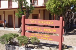
Museum Sign Picture

Museum Sign stands at the Fort Huachuca Museum and Commemorates Geronimos capture in 1888.

The Fort Huachuca Historical Museum was established in 1960 but the Fort itself has a long history of over 135 years in Southeastern Arizona. It tells the story of the Army in the West from 1846 to the present day, with emphasis on SE Arizona. The old portion of the Fort is on the National List of Historic Places and many of the buildings around the museum date back to the late 1800s and early 1900s. The visit to the museum is free but there is a request that you donate $2 in funds to help keep the exhibits and building maintained. The museum covers all aspects of the fort. The original museum shows the history of the fort in the early days up until World War II. The Annex museum is the US Army Intelligence Museum. In addition to the museums there is a self guided walking tour of the old Fort that you can take to see the different buildings.

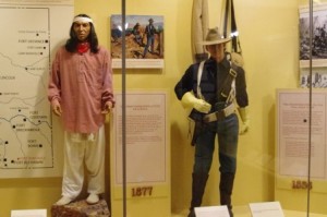
Cavalry Officer and Apache Display Picture

Cavalry Officer and Apache Display at the Fort Huachuca Museum

The US 6th Cavalry Column from Tucson, lead by Captain Samuel Whitside, made camp on the northern end of the Huachuca Mountains in March1877. The camp was only temporary to begin with but after assessing the site and the strategic location, a proposal was made to the Army headquarters in Washington to make the site a permanent post. The camp was a perfect spot to block the Chiricahua Apache escape route into Mexico. The location provided a view of the entire San Pedro Valley, over to Mt. Graham, The Dragoon Mountains, The Chiricahua Mountains and the Mule Mountains around Bisbee. General of the Army William T. Sherman personally visited the camp in 1882 and recommended to the Secretary of War that the camp should become a permanent post.

Apache Indian Scout Statue picture

The Apache Indian Scout Statue is on the grounds in from of the Museum Annex at Fort Huachuca.

During the Apache War, the Army recruited some Apaches to be scouts for the Army. These scouts would guide the troops in pursuit of the Apache that were waging war. Fort Huachuca was instrumental in winning the war with the Apache and the final capture of Geronimo. There was proximity to the water from creeks that feed the San Pedro River, timber from the Huachuca Mountains for building material and close support for Fort Bowie. After the Apache war was concluded many of the posts in Arizona were shut down and abandoned but Fort Huachuca survived all the cuts.

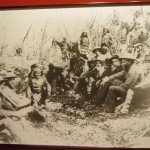
Geronimo Picture

This Geronimo Picture is on display at the Fort Huachuca Museum

The Fort was home for the men of the 9th and 10th Cavalry, the famed Buffalo Soldiers. The regiments were authorized by Congress in 1866 and were manned by former slaves, black free men and black troops that fought in the Civil War. They originally were led by white officers. The Buffalo Soldiers were assigned throughout the west and served courageously in the Indian wars, Spanish American War, with General Black Jack Pershing in foray into Mexico and in the Philippines. In Fort Bayard, NM, near Silver City, there is a statue of Corporal Greaves, who won the Congressional Medal of Honor in 1879 fighting the Chiricahua Apache. The name Buffalo Soldier is purportedly given by the Cheyenne to the troops because their hair was wooly like the buffalo.
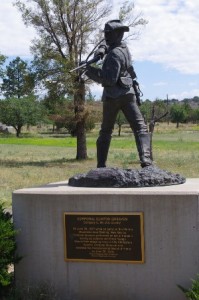
Statue of Corporal Greaves Picture

The Statue of Corporal Greaves can be found in Bayard NM. This Buffalo Soldier was awarded the Congressional Medal of Honor.

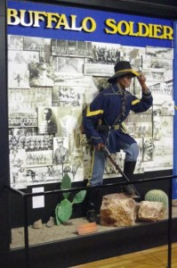
Buffalo Soldier Display Picture

Buffalo Soldier Display at the Fort Huachuca Museum

The exhibits are laid out very well and give you the history of the troops that manned the fort. There is a lot of information to read including quotes from people that have served at the fort. You will find timelines and old photographs of the fort and people that were there. I didn’t know it until I was looking at the exhibit of the baseball player that some of the stars from the Negro Leagues came from the Fort Huachuca Team. Angie and I have met some of the men who do reenactments that are featured at the various functions around Cochise County. We have had some long talks with one man, Willie, and he has told us many stories of the Buffalo Soldiers and their lives. If you have a chance to talk with Willie you will learn from a very well versed person on the historical events surrounding the Buffalo Soldiers.
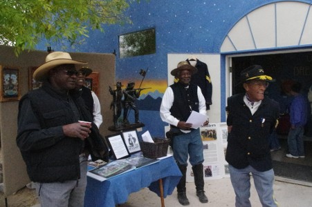
Reenacter picture

The Buffalo Soldier Reenacters come to many fuctions in Cochise County. Willie, the man on the right, is very knowledgeable about the history of the Buffalo Soldiers. We enjoy talking with all of these guys.

The museum is open Monday to Saturday 9 to 4. It is closed on Sundays and Federal Holidays. To gain entry to the Fort you must be an American Citizen and show your driver’s license prior to driving onto the fort. The MP at the main gate will give you a map to show you where to go to find the museum. A small map can be opened if you click here. The Fort is only about 45 minutes from Down By The River B and B, the San Pedro River B & B. After seeing the museums there are also some good birding areas that are inside the fort in Huachuca and Garden Canyons. The Elegant Trogan can be found in this area and some of the local birders know exactly where. So come and spend some time at The Lodging Hub of Cochise County and go on a tour of the Fort Huachuca Museum.

Kartchner Caverns State Park Review

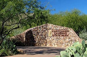
Kartchner Caverns Entry Sing picture

Kartchner Caverns State Park is the most pristine live cave in the United States.

Kartchner Caverns State Park is probably the best preserved living cave in the United States. No one has set foot on approximately 85% of the cave floor. It is located south of Benson on State Route 90. I recently wrote a blog on the Good Enough Mine Tour. In that blog, I mentioned that there are 3 underground adventures in Cochise County and Kartchner Caverns was one of these. When we started our Southeastern Arizona B & B, Kartchner had only been opened 5 ½ years. This is one of the best things to see in Cochise County but I am surprised that so many people in Arizona have never heard about it. The tours are limited to about 750 people per day and reservations are recommended although they hold back 100 tickets for walk-ins. There are 2 tours of the caverns. One is the Rotunda/Throne Room Tour featuring a massive 58 foot tall stone flow column called Kubla Khan and the second is the Big Room Tour featuring different types of calcite features and formations. Both take about 1 ½  hours to complete and both tours are totally different. You can do both tours in a day but you can only do the Big room Tour from October 15 until April 15. The Big Room closes due to the approximate 1500 bats that nests there during the spring and summer months.

The history of the cave goes back to 1974 when it was first discovered by two spelunkers, Gary Tenen and Randy Tufts. They were exploring the limestone cliffs of the Whetstone Mountains and found a sink hole with a crack in the earth that led into the cave. They kept their find a secret while exploring the cave over the next 4 years. Then in 1978, they informed the Kartchner Family of their find. They went on to explain how extraordinary the cave was and that there was a need to preserve the exceptional colors and formations. They all agreed to keep the find a secret.

Over the next 10 years, the Kartchner family, Tufts and Tenen worked at coming up with a way to preserve the caverns privately while still keeping the location a secret. If the cavern’s existence had become known to outsiders, it would have been vandalized. Finally the Kartchners approached the State of Arizona Parks Department for help. After the group approached the State they worked with people in the Parks Department along with Governor Babbitt to sell the caverns to the State. The immediate problem for the successful transaction was how do you spend public money and still keep thet secret at the same time. A way was found and the State Legislators and Senators were shown pictures of the caverns in closed session. The legislation to purchase the complex was passed by both houses on the same day and sent to Governor Rose Mofford to sign. On April 29, 1988 the bill was signed into law. That will be 25 years ago next week.

Over the next 11 years, the Parks Department planned how to provide for the toursists while still preserving and maintaining the integrity of the caverns. The Parks Department determined that building a multi-door air lock chamber to seal the humid caverns from the effects of the dry desert air and providing a misting system was necessary for the preservation of the cave. Mining professionals were brought in to excavate the passage though the solid rock that shielded the caverns. The Center was built, paths were made, railings were put up, seating and lighting were installed and a means to wash down the cave at the end of every day was devised. Finally on November 5, 1999 the Rotunda/Throne Room Tour was opened to the public. On November 11, 2003, the Big Room Tour was dedicated. Unfortunately Randy Tufts had passed away in 2002 and wasn’t able to see the Big Room open to the public.

A video has been produced by the Parks Department that shows you some of the special things you will see when you do the tour. Reservations for the tour can be made at this link. I also found a photo gallery online that has pictures of some of the things you will find in the caverns. The Cavern has shields, soda straws over 21 feet long, stalactites, stalagmites, and helictites, formations that defy gravity. There are features such as bacon and fried eggs; looking at them will make you hungry unless you have had one of BnB breakfasts.

The Discovery Center houses the museum, a gift shop, a restaurant and a movie theater that show a short film about the discovery of the caverns. It lasts about 15 minutes and is something you will want to see if you have never visited before. The museum has the bones of an 86,000 year old ground sloth that was found in the cave. You can’t take photographs on the tour nor can you carry purses, backpacks, fanny packs, food, water, nor other items. Check with the park website for other restriction. For those of you that bring a picnic lunch there are picnic areas and shelters for you to have that lunch.

There are two trail heads at the park for those that want to hike. One is the 4.2 mile Guindani trail that climbs from 4750  to 5620 feet. It starts out easy then becomes moderate to difficult and the last bit of it is strenuous. The other trail is the 2.5 mile Foothill Loop trail that is rated moderate to difficult. There is also a little Hummingbird Garden walk that is located at the Center. As always when doing desert hikes, take plenty of water, sunscreen and a hat. Keep on the trails and watch for snakes during the warmer times of the year. Keep an eye out for wildlife. There are 63 different birds that have been sited at the park along with mammals, such as mountain lions, coyote, fox, coatimundi, rabbits, skunks raccoon and deer. There are also many insects and reptiles that can be seen in the area.

When choosing Kartchner Caverns lodging, think of Down By The River B&B. It is about 30 minutes from Kartchner but you can cut 10 to 15 minutes off the time with a desert short cut. Ask us about it. The hours of operation for the park are as follows: When you are lodging at Down By The River B and B, schedule your tour after 10:30 so that you won’t be rushed at breakfast.

Summer Hours (June 1 – Sept. 30): Gate Hours 7 am – 10 pm, Park Hours 8 am – 5 pm, Discovery Center Hours 9 am – 5 pm.

Winter Hours (October 1 – May 31): Gate Hours 7 am – 10 pm, Park Hours 7 am – 6 pm, Discovery Center Hours 8 am – 6 pm. The Discovery Center is closed half-day on Thanksgiving & December 24, and all day on December 25.

HawkQuest Guests

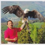
Kin and eagle picture

Kin with a Bald Eagle during a demonstration from HawkQuest Literature

We had the pleasure of hosting Kin and Patti Quitugua from HawkQuest during their stay at our San Pedro River B and B. During their stay I found out that Kin had originally lived in Guam before finally ending up in Parker Colorado. I talked to him about HawkQuest and what his business did. Kin was one of three co-founders of HawkQuest back in 1986. The purpose of  HawkQuest is to educate people about raptors and their place in the ecosystem while sharing the message concerning biodiversity and nurturing respect for our land and stewardship of the environment.

The goal is to make education fun and meaningful for the people that attend the programs that HawkQuest puts on.  The education process allows for the audience to be part of the experience while learning about the hawks, eagles, falcons and owls. The team brings the birds to different venues for persons of all ages, preschool children to senior citizens. They will do lectures about birds of prey, HOOT – hands on owl training, and Classroom in the wild where Harris Hawks fly in the open and show off their hunting skills. They also do booth appearances at shows.

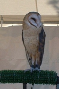
Barn Owl Photo

Barn Owl in Tubac at the Arts Fair.

The funny thing is that after we introduced ourselves, I was able to remember that Barb and I had gone to Tubac during an art show about 5 years ago. At that show we came to a booth that had eagles, hawks and owls perched in the open. The birds were calm and the handlers were telling everyone about the birds. I told Kin about this visit I remembered we had in Tubac and then found out it was his company HawkQuest that was at that show. I still had some old pictures so I printed a copy of them  and showed the photos to him. Kin laughed and said yes that was one of his associates that was holding the eagle.

During the time that Kin and Patti were here, they headed down to the San Pedro River behind the BnB. While birding, they were lucky enough to see a Peregrine Falcon flying up the river. Kim knew what the bird was because he has a falcon that he flies during his demonstrations. We have never had anyone tell us about seeing this bird while visiting and so we are adding this to the website and crediting Kin for the view.

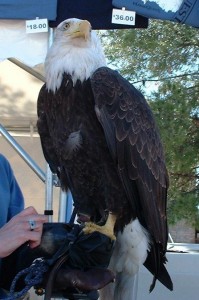
Bald Eagle Picture

Bald Eagle was the hit of the show with everyone wanting the photo.

Shows you how small a world this really is doesn’t it? The next time you decide to take a short break and do some birding and you don’t have time to go to Colorado to see the people at HawkQuest, think about Down By The River B and B in St. David, AZ. We are centrally located and short distances to many locations in Cochise County. We are the B&B that is the “Lodging Hub”  in Southeastern Arizona.

If your interested in seeing just exactly what HawkQuest is all about you can visit
their website at www.hawkquest.org
or their facebook page at HawkQuest.

Tombstone Good Enough Mine Tour

Southwestern Arizona offers many experiences to give you the “Old West” feeling. One of the things you can do in Cochise County is to go underground on tours such as Kartchner Caverns in Benson, The Copper Queen Mine in Bisbee and The Good Enough Mine in Tombstone. Each has its own charms and I have experienced them all. Angie and I were in Tombstone prior to the Rose Tree Festival and after touring the Rose Tree we decided to take in the mine tour. We got to the Toughnut Street location 10 minutes before the tour began. Early arrival allows you to look at the old mining equipment that is on the property.

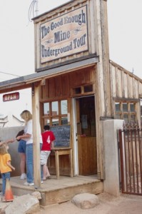
Good Enough Mine

The Good Enough Mine Ticket Office is open for business.

I will give you the short history behind the mining that was done in Tombstone. In 1877, Ed Schieffelin found an ore deposit and filed a claim. He called the mine the Tombstone, because he had been told by his friends that a tombstone was all he would find looking for ore in the Apache wilderness. That is how the town got its name. In 1878, he filed another claim for the Good Enough Mine. Over the years, Ed filed 19 different claims. The mining tunnels from the different mines intersect in places. Ed and his partners also established a lumber mill in the Huachuca Mountains and a stamping plant to process the ore in Contention. Tombstone became the largest town between San Francisco and St. Louis. In the end Ed, his brother Al and a mining engineer, who were partners, sold their mines to Consolidated Mining for $600,000 each, $12 million in today’s dollars. The mines turned out to be one of the richest strike in the southwestern United States.

After the company that owned the mine decided it wasn’t worth anything, The Good Enough Mine was purchased by the ex mayor of

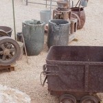
Mining Equipment picture

Mining Equipment is available for you to check it out.

Tombstone and his wife for $2000. They wanted to bring back something that made was the reason for Tombstone to exist. After the purchase the real work began. As the mine had been abandoned, the shafts and tunnels were filled with trash and dirt. Over a 6 year period, the debris was removed from the mine, paths were made and the walls were washed down so that visitors could see minerals that were still in the walls. The paths were made smooth and relatively level with the exception of the stairway which takes you down to the main mine trail. In places the roof of the mine tunnels are painted red where the rock hangs down. Head protection is needed and hard hats are available if you don’t have one. Prior to the tour opening, the mine was inspected for safety and there are some areas where additional safety

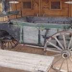
Ore wagon picture

Ore wagons were pulled by the mule teams to the Contention stamping mill for processing the ore into silver.

screening and shoring have been added to stabilize the rock. The organized tours were started about a year and a half ago and the experience has been improved by the owners over the years.

At the beginning of the tour, our guide introduced himself and gave us a demonstration of what it took to drill holes in the rock walls by hand. The drilling was done so that dynamite could be placed in the rock face. Unlike the western movies where miners were using picks and shovels to get the ore out, miners needed to blast the ore deposit into pieces that could be loaded on to carts and brought out of the mine. The video I made gives a

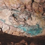
Ore in the wwwwall Picture

You can see the copper ore still in the mine. This was a silver mine but copper, gold and lead were also found here.

demonstration of what it took to drill a hole into the rock. After the demonstration, we walked down the slope toward the wash and into the mine entrance.

At the entrance we were told about the debris removal and what we would see during the tour. The mine was worked for many years from the 1880s into the 1930s. Our guide said that he had found an El Paso newspaper down in the mine dated 1908. We were also told that one of the urban legends about the mine being flooded is only partially true. As the miners dug deeper chasing the silver ore, they reached a level where water entered the mine. Pumps were brought in and installed and pumped the water out until the miners reached the 700 foot level. When the pumps failed the water returned to the 500 foot level again covering the pumps. The mine never totally flooded but mining below 500 feet is not feasible.

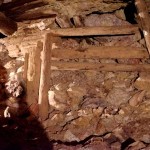
Shoring picture

Shoring the ceiling with big timbers kept the mine roof stabilized.

The mine tour starts with stairs that go down 70 feet to the loop trail that has been made in the mine. The entire trail is lit and there are specific side areas and niches that are lit for people to see different aspects of the mine. Our guide pointed out tunnels and shafts that were roped off. He explained that the entire inner-connecting complex of tunnels goes under the town of Tombstone and out into the surrounding areas. To illustrate his point he showed us one that goes under the wash and comes out at the Toughnut Mine entrance. The mine is a man made hard rock cave and if you are claustrophobic, it isn’t not for you. The miners followed the ore wherever it went, horizontally or vertically. Some passages are low and narrow and other places being are large rooms with 30 tall ceilings.
The miners spent 12 hour shifts in the mine and worked by candlelight at the beginning. Carbide lights were introduced much later in the history of the mine. Unlike coal mines, there was no gasses emitted from the deposits and explosions from a live flame did not happen. The air is fresh in the mine. The complex of tunnels creates a draft that is flowing throughout the mine. We were shown some of the items left by the miners in the tunnels from tools to empty cans of food. The mine structure is sturdy and has some shoring. An earthquake in Sonora Mexico in the 1890s didn’t affect the structure at all. There are some areas of town on Toughnut Street that are collapsing due to the mine. If you go to the Courthouse, there are detail drawings there that show the mine tunnels and the levels of the mines in Tombstone. It gives you some more information on just how big the tunnel complex is.

Near the end of the 1 hour tour, we were shown some ore samples from the mine. Most of the silver from the mine was shipped off to New Orleans and was minted into coins. We were also told of a more extreme tour that is done on Saturdays and it takes about 3 hours. The Toughnut mine tour goes back into areas of the mine that are seldom seen. This tour requires a minimum age of 10 years old, hard hats, lighting and water. It is advisable that you have old clothes, gloves, knee pads and protection for scrapes. When you are making plans to go on any of the Cochise County underground tours, remember that your lodging choice should be Down By The River B and B, “The Lodging Hub of Cochise County.” We are located in St. David about 20 minutes from Tombstone and our San Pedro River BnB is perfect for that quiet relaxing stay in Southeastern Arizona.

Tombstone Rose Tree Museum Update

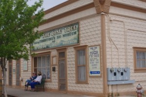
Rose Tree Museum Picture

The Rose Tree Museum is located on 4th and Toughnut Street

Recently I did a blog about the Rose Tree Festival which is held in Tombstone, AZ. The Rose Tree is located on 4th and Toughnut Streets in the back of the Rose Tree Museum. I did the blog prior to the Tombstone Rose Tree Festival to let people know about the festival. I wanted to supplement my collection of pictures of the rose and provide more detail as an update to the previous blog.  On April 4, Angie and I had a chance to go to the Rose Tree Museum. Tombstone is a short drive from our San Pedro River BnB. Angie had never been to the museum and I wanted to go while the Lady Banks Rose was in bloom. We were not disappointed with the display of the rose bush. The Tombstone Rose Tree Festival is held when the rose is at the peak of the blooming cycle. We went the day before the festival so that we wouldn’t be fighting the crowds and we could get some pictures without a lot of people blocking the views. The rose tree was at the height of beauty and there are still some buds getting ready to bloom. The rose is about 1 inch in diameter and the blossoms come in a cluster. The smell of the blossoms was a nice scent but not overpowering.
Rose tree stock picture

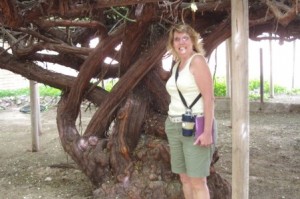
Angie poses at the stock of the Rose Tree

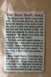
When we arrived, we paid our $5 entrance fee and walked through the museum on our way out onto the patio to look at the roses. We found a little plaque on the east wall that gives a short history of the rose tree. After reading the information, I got Angie to pose at the tree so that there was a reference to the actual size of the stock. The stock is large and really rugged looking. It is amazing that this plant is still alive. It had to be lovingly cared for while growing in the desert for over a century.  The rose is growing over part of the Good Enough Mine. There have been some concerns about the ground collapsing near that part of Toughnut St and the adjoining museum grounds. Recently the road has been closed to traffic and part of the property that the rose tree has been fenced off due to these concerns. The mine entrance is just to the west of the Rose Tree and there are daily tours down into the mine.

Plaque Picture

The Rose Tree History Plaque is posted.

Rose tree stock picture

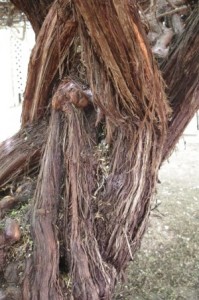
The stock of the rose tree is rough to the touch.

Rose tree under the canopy picture.

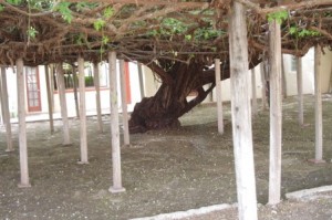
Under the canopy of the rose tree you are shaded and the tree is supported by posts and steel beams.

To show just how large the rose tree is, I wanted to take a single picture from the platform that is provided. It was not possible for me to show the extent of the rosebush in a single photo unless I had a fisheye lens on the camera. A fisheye lens distorts the picture and doesn’t reflect the true size of the subject. Instead I got back as far as I could and then did a panorama shot with 5 separate pictures. I then combined the pictures with a program to join them together and place them in alignment. If you look at the picture, under the arbor you can see a couple of people standing. This will give you some perspective as to the size of this 127 year old bush. It was a cloudy afternoon when I to the picture and the colors are not as vibrant in this photo. On a brighter day the yellow roses would have stood out better but this does give you an idea of what you will see. Click here to see the panorama.

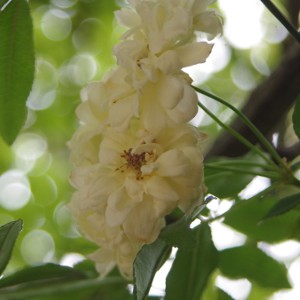
Lady Banks Rose Blossom Picture

Lady Banks Rose Blossom

After we finished viewing the rose tree, we returned to the small museum and toured the exhibits. There are collections from the past owners of the building and rose. Another section houses mineral displays. There are also old photos of old historical significance which are hung up on the walls in the museum. There is even a neon sign that is on display that was used when the building was known as The Rose Tree Inn. The Museum also has a small bookshop.  We did enjoy the Museum and feel that this is a good place for people to visit  when they tour Tombstone.
If you go to see the rose tree consider Down By The River B and B for you lodging requirements. We are located in St. David and we are a short drive to Tombstone.

The Hummingbirds Have Returned

In the last week and a half the hummingbirds have returned to the San Pedro River Valley and are at the feeders at Down By The River B and B. So far most of the hummers are black-chin hummingbirds but I have spotted an Anna’s Hummingbird in the mix. The San Pedro area around St. David is a nursery for the black-chin and they spend all summer here nesting and raising the young. We have had a nest in the carport area a couple of times over the years and many times guests have never noticed that it was located atop one of the support posts under the roof cover.

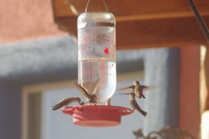
Hummingbird feeder picture

Black-chin hummingbirds gather at the feeder for nectar

It won’t be too much longer and we will be getting rufous hummingbird that stop on their way to Alaska. We can always tell when the rufous are here. They will sit in a tree or other location that allows them to see all the feeders and they will run all the other hummingbirds away as they come toward the feeders. These black-chins do employ tactics sometimes or so it seems. The hummers will go in with multiple birds and some will get a drink of nectar while old man rufous is running another one off.

Our guests have spotted other species of hummingbirds on the patio while watching the black-chin, anna’s and the rufous. They have seen magnificent and calliopes at the feeders but these are rare occurrences. Last fall I got a picture of two Annas having a fight at the feeder. If you haven’t seen it when I posted it here is a link that will take you to the video. We also have the Gila Woodpecker raid the feeders and I have a blog on that too. The rufous will leave the woodpecker alone as he knows his limitations in that contest.

If you like to watch the hummingbirds and the woodpecker, then come on over to our San Pedro River BnB and relax on the patio while the action takes place in front of you. Sometimes if you wear red earrings or have a red flower shirt, a hummer will come right up to you to check it out. We have had hummers within inches of ears checking out a ruby. You may even want to enjoy some wine while you watch. Try some of the Arizona wines that are made in the area.  We are located in St. David, AZ on the San Pedro River at the northern end of The San Pedro National Riparian Conservation Area. We are centralized with access to many of the Cochise County attractions with short day trips. That is why we are the Lodging Hub of Cochise County.

San Pedro River and Southeastern Arizona Bird Migration

The migratory birds are starting to make their way through Southeastern Arizona using the San Pedro River highway. The cottonwood trees have fully leafed out in the last few weeks and the temperatures are in the 70 and low 80s. It is a great time to be outdoors and watch all the activity. Lizards are out and on the hunt. It won’t be long before the tent caterpillars to start feeding on the leaves and the birds will be right there to take advantage of it.

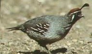
Gambrel Quail Picture

Gambrel Quail feeding below our feeders

In the last few days Vermillion Flycatchers have been feeding on the property. You can’t miss the bright red flash as they chase an insect. Some swallows flew through this morning at our San Pedro River B and B. The normal sparrows and finches are at the feeders and doves are on the wing. An of course the Gila Woodpeckers are coming to the hummingbird feeders for drinks of nectar. We also noticed that the Gambrel Quail are around now. Yellow headed blackbirds are here is Saint David also. Our resident Says Phoebe is here building her nest again. This will be the 5th year that she has nested on the patio beams.

Raptors are also moving up the river. Just last week we saw 2 Mississippi Kites fly by and stop at the fence. While watering I spotted a Gray Hawk. Wezil Walraven guided a couple of birders that stayed with us at Down By The River last week and he told us that he had seen a common black hawk along with the gray hawks just to the south of us. So the show is beginning with a lot of new birding activities to see here along the San Pedro.

One caution is that the weather is pleasant but this is the desert so take water with you when your out. I saw that the humidity yesterday was very low. Actually at 6 PM when it was 68 degrees the humidity was 1 %. I have never seen it that low before. You will be losing water in that humidity so make sure you hydrate. Also humidity that low increases the fire danger so please be careful. To enjoy all this just come on down to this part of southeasstern Arizona and stay with us at Down By The River B and B. We are located in Saint David on the San Pedro River at the northern end of the San Pedro River National Riparian Conservation Preserve.

Tombstone’s Rose Tree Museum

How would you like to see the largest living rose bush? To do that you have to travel to Tombstone and visit the Rose Tree Museum located on 4th St near E. Toughnut St. As the story goes, in 1885 or 86 depending upon who you talk to, a woman by the name of Mary Gee received a rose root from her family in Scotland. They sent it to her with other things so she could have something to remind her of home. The rose root was from The Lady Banks Rose. There is a festival in Tombstone every year to celebrate the Rose Tree during the time that it is in bloom. This year, 2013, the festival runs from April 5 through April 7. Since it did come from root stock that had been in Scotland prior to arriving in Arizona, the plant is over 127 years old. That alone is impressive.

But even more impressive is the size of the rose tree. The main stock is about 12 feet in circumference and is close to 8 feet tall where it branches out.  Yes you do walk under it and it covers almost 9000 square feet or a fifth of an acre. That is larger than some house lots at a tract home subdivision in Phoenix. The flowers on the rose tree are small compared to the hybrid tea roses that are available at nurseries today. The pale yellow blossoms bloom only one time during the year during the festival time for about 4 weeks. When the blossoms are finished you have to wait another year before you can see it again. There is a staircase to a viewing platform that allows you to view the top of the rose tree.

Photos of Rose Tree Museum and Books, Tombstone
This photo of Rose Tree Museum and Books is courtesy of TripAdvisor.

The Rose Tree holds the record with the “Guinness’ Book of World Records” which list the rose tree as the largest rose vine in the world. Various pictures of the vine and the blossoms can be seen on the Picture Tombstone website.  Purportedly in 1937  the author of  “Believe It Or Not” fame,  Robert Ripley visited Tombstone and stated that to his knowledge the Rose Tree was the largest rose bush in the world at that time. No one has contested the record holder’s claim. The Lady Banks Rose is actually native to central China where it grows in the mountains. It was brought to England by J. D. Parks and introduced to the London Horticultural Society in 1824.

The Rose Tree Inn Museum is open every day from 9:00 AM to 5:00 PM, except on Christmas. Admission is $3. So when you go to see the Rose Tree you should consider staying at Down By The River B and B, located on the San Pedro River in St. David. We are centrally located and are short day trips from all the Cochise County attractions.

What is that wind sock for across the road?

There are a lot of unusual things and interesting people that are found in Cochise County. We have famous people, people that provide optics to the military and NASA, people that are cowboy poets and story tellers, a doctor that specializes in immunity problems such as when molds infect the body, visionaries that want to protect the environment, people that are authors and I could go on with more examples. We also have people who have different occupations that they are good at doing. I wrote about one person, Wezil, who has spent his whole adult life doing bird tours for clients. There are also people who have hobbies that aren’t the normal ones.

One of the questions that I have gotten when I talk to guests is “What is that windsock for? Is there a landing strip over there on the other side of the road?” Well as a matter of fact, there are two landing strips here at DMR Ranch where Down By The River, a San Pedro River B and B, is located. Chester is one of the first people that we met when Barb and I came down here and decided to build our b&b. He is a first class heavy equipment operator and did all the excavation on the property when we built this southeastern Arizona b&b. Chester also has an airstrip on the other side of Efken which he uses for his hobby.

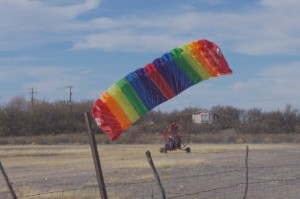
Paraplane chute inflation picture

The fan from the paraplane inflates the chute prior to taking flight.

Chester has flown off the landing strip many times since we have been here. He operates less now than when we moved into the b and b in 2005. This is mainly due to the cost of fuel. Every once in a while when the weather is nice and calm, he goes out, checks the strip for holes and rocks and then preps his paraplane for flight. He is able to fly for an hour or so and then returns home.

An explanation of Chester’s wonderful flying machine is in order here. Paraplanes were developed in the early 1980s. The paraplane is made of two main parts. One is the specially designed parachute that gives the plane lift and the other part is the framework that is the seat for the pilot and supports the motor and fan that powers the plane. The frame can be best explained as something you would use in a swamp with the big fan at the back. The only difference is that this frame has wheels instead of floatation devices.

Paraplane take off picture

The paraplane take off can be done in a relatively short distance.

The parachute is laid out on the ground behind the fan in a specific manner. After starting the engine, the fan blows air at the parachute and the chute lifts off the ground into the air. Letting off the brake the frame moves forward and the chute rises further. It takes approximately 50 feet to become airborne and after a couple of circles around the field the plane has reached enough height to pass over the power lines and surrounding hills. The paraplane is steered by leaning left or right to make turns. To gain height you increase the fan speed or reduce the speed if you want to lose elevation and land.

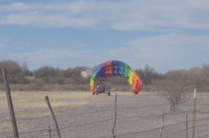
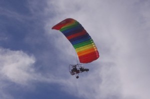
paraplane flying overhead picture

Paraplane in flight over our B and B

When Chester flies, it is usually on a Sunday morning when there is no wind. We have had guests watch him take off after breakfast. The last time he flew, I got my camera and took pictures of him taking off. His paraplane has a colorful chute and I am sure that this helps other planes see him as he is flying. It is fun to watch him leave but I think that having my two feet on the ground works just as well for me. If I fly, I like fixed wing aircraft since it gives me a greater sense of security. But that is just me. If you are lucky when you come on your visit to Down By The River, you will have a glimpse of Chester as he takes off or lands.

The Amerind Foundation Museum

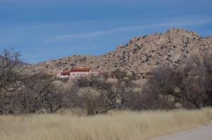
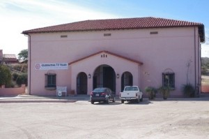
Amerind picture

The Amerind Foundation is sited in Texas Canyon amongst the rocks

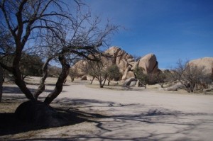
Located in Cochise County, Texas Canyon is a scenic granite outcrop made up of a jumble of boulders and rock. The area that was caused by volcanic activity millions of years ago. It never reached through the surface of the earth and the surrounding ground has eventually worn down over time to expose the rock formations. I wrote a blog on the history of Texas Canyon a little while ago. In Texas Canyon there is a museum that is a unique experience for travelers to Cochise County. This museum is called the Amerind Foundation Museum and it celebrated the 75th Anniversary of its founding in October of 1937. Amerind is derived from combining the two words American Indian.

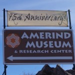
Amerind Sign

Sign on Dragoon highway point the way to the Amerind

William Shirley Fulton was the founder of the Amerind. He born and raised in Connecticut. He was interested in archaeology and started to come to Arizona in 1906, prior to Arizona becoming a state in 1912. He visited many places in the state including the Hopi and Navaho reservations. He was particularly interested in the Southwest Native American cultures and collected many items of interest. During one of his trips he heard about Texas Canyon and the supposed prehistoric artifacts that could be found. While in Cochise County in 1930 he purchased the property that now is home to the Amerind Museum. He started searching the property for artifacts and did archaeological digs on parts of his ranch. He became more focused and honed his skills, he published accounts for eastern museums telling about what he found at the sites.
After founding The Amerind and incorporating, he hired an archaeologist and started to support research on a larger scale. His efforts produced one of the finest privately held collections in the United States. Over the years since it’s founding, The Amerind has grown

Museum Building picture

The museum building houses the Native American Artifacts

from just a house to a museum of Native American artifacts, a research facility, library, art gallery, storage facility and gift shop. In 1952 Charles Di Peso was hired as the first Director of the Amerind. His tenure lasted 30 years until his death and he expanded the focus of the foundation to include excavations in other parts of Arizona, New Mexico and Northern Mexico. Di Peso was instrumental in doing the excavation at Casa Grandes in Chihuahau, Mexico and excavated the large village. Prior to that, archaeological work in Mexico was done further south and concerned the Aztecs, Olmecs and Mayan civilizations. Northern Mexico was not thought to be worth studying.  He published eight books on the excavation and that is the leading work in the field even to this date. Displays of this work are on display at the museum.

Amerind art museum picture

The Amerind Art Museum is housed in this building

Since Di Peso’s death in 1982, The Amerind became less involved in archaeological excavations. The focus is now on the research and providing multiple seminars and discussion groups for various topics and the preservation of the artifacts at the museum. Prior to 1985 the museum was only opened by appointment to visitors. The museum houses exhibits gathered from Alaska to the plains, the Southwest and also to locations in South America including Ecuador and Peru. The displays tell you the story of the artifacts and something of what life was like at that time. Allow a couple of hours to tour the museum and read the interpretive exhibits. The museum houses an the estimated 21,000 artifacts.

Picnic ground picture

The museum has picnic facilities on the grounds for use by guests.

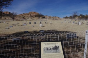
Pioneer CemeteryThe Amerind Museum is open to the public from 10 AM to 4 PM every day except Monday. Special events and exhibits are held year round at the museum. Check out Down By The River’s events page to see the things that are happening during the upcoming months at locations near the b&b. The grounds of the ranch have picnic areas and also include the site for the Texas Canyon Pioneer Cemetery of the original Texas Canyon Settlers. The rocky scenery of Texas Canyon accents the museum building and the surrounding area. Hiking around the grounds will lead you to fun and discovery. Down By The River B and B is a perfect location to stay at when you visit Amerind. The San Pedro River BnB is centrally located to many of Cochise Counties attractions. To get to the Amerind take I – 10 east to Exit 318 and head south on Dragoon Highway about a mile and you will see the sign at the entrance. The road to the museum is on the left.

  • Archives

  • Categories

facebook twitter pinterest youtube mail